English   Română   Español   Français   Deutsch  

getamap.net

Africa

Oceania

Asia

North America

Europe

South America

Antarctica


Ponta Diogo Nunes

/ Sao Tome

0°22'60" N
6°43'0" E
~164m asl
00:03 (GMT - UTC/GMT+0)

Ponta Diogo Nunes (Ponta Diogo Nunes) is a point (class T - Hypsographic) in Sao Tome (São Tomé), Sao Tome And Principe (Africa) with the region font code of Americas/Western Europe. It is located at an elevation of 164 meters above sea level.

Its coordinates are 0°22'60" N and 6°43'0" E in DMS (Degrees Minutes Seconds) or 0.383333 and 6.71667 (in decimal degrees). Its UTM position is KF44 and its Joint Operation Graphics reference is NA32-13.

Current local time is 00:03; the sun rises at 08:54 and sets at 21:01 local time (Africa/Sao_Tome UTC/GMT+0). The standard time zone for Ponta Diogo Nunes is UTC/GMT+0
In 2024 DST starts on - and ends on -.

A Point is a tapering piece of land projecting into a body of water, less prominent than a cape.


Country
 Advertisements:


 Advertisements:


Weather Ponta Diogo Nunes (Cloud cover, Temperature, Wind speed and Precipitation mm probab.)

Wed


Apr 24
Clound 10-20-20-100
 
28 °C min
29 °C max
13 km/h
Thu Jan 1

Thu


Apr 25
Clound 0-0-70-70 Lightning
 
28 °C min
30 °C max
20 km/h
Thu Jan 1

Fri


Apr 26
Clound 0-0-10-10
 
28 °C min
30 °C max
15 km/h
Thu Jan 1

Sat


Apr 27
Clound 10-10-10-80
 
28 °C min
30 °C max
11 km/h
Thu Jan 1

Sun


Apr 28
Clound 20-10-10-80
~5 l/m2 34%
 
28 °C min
30 °C max
23 km/h
Thu Jan 1

Mon


Apr 29
Clound 20-10-60-100 Lightning
~13 l/m2 68%
 
27 °C min
30 °C max
22 km/h
Thu Jan 1

Weather Graph

Ponta Diogo Nunes (Sao Tome) 7 day forecast
 

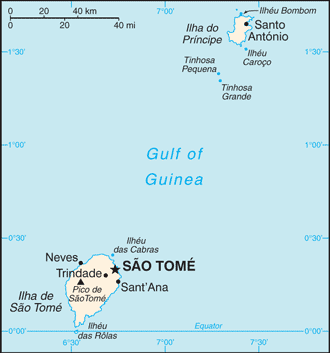
Map and Photos Ponta Diogo Nunes


Comments

--- There are no comments yet ---


Add a new comment:


You have to log in to add a comment!


Members area


Register

Forgot password?

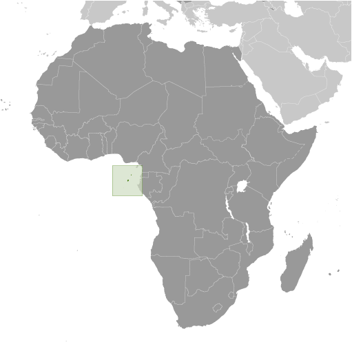
Sao Tome And Principe (Sao Tome):

Advertisement


GPS points near Ponta Diogo Nunes


square Praia Lagarto (1 km)

square Rio Melo (1 km)

square Nazare (1 km)

square Agua Telha (1 km)


square Cobras (1 km)


square Oquedelrei (2 km)

square Oquedelrey (2 km)


square Bela Vista (2 km)

square Santo Amaro (2 km)

square Praia Coba (2 km)

square Praia Koba (2 km)


GPS points from Sao Tome And Principe (Sao Tome)

square Bombaim Sao Tome

square Lamaporco Sao Tome

square Praia Cle-cle Sao Tome

square Pico Zagaia Sao Tome

square Santo Amaro Sao Tome

square Val Carmo Sao Tome


square Monte Macalu Sao Tome


viewweather.com sv.ViewWeather.com
fr.ViewWeather.com
da.ViewWeather.com
de.ViewWeather.com
es.ViewWeather.com
www.carpati.org
www.searchromania.net
Deblocari usi
es.getamap.org
fr.getamap.org
de.getamap.org
nl.getamap.org
da.getamap.org
www.getamap.org
Links
Terms of use
Privacy policy

# 0.0697 sec 

contact AT getamap.net

© 2006 - 2024  https://www.getamap.net/