English   Română   Español   Français   Deutsch  

getamap.net

Africa

Oceania

Asia

North America

Europe

South America

Antarctica


Bukit Prigi Kling

/ Singapore (general)

1°10'7" N
103°44'20" E
~29m asl
06:38 (SGT - UTC/GMT+8)

Bukit Prigi Kling (Bukit Prigi Kling) is a hill (class T - Hypsographic) in Singapore (general), Singapore (Asia) with the region font code of Asia/Pacific. It is located at an elevation of 29 meters above sea level.

Its coordinates are 1°10'7" N and 103°44'20" E in DMS (Degrees Minutes Seconds) or 1.16861 and 103.739 (in decimal degrees). Its UTM position is UG52 and its Joint Operation Graphics reference is NA48-10.

Current local time is 06:38; the sun rises at 08:55 and sets at 21:02 local time (Asia/Singapore UTC/GMT+8). The standard time zone for Bukit Prigi Kling is UTC/GMT+8
In 2024 DST starts on - and ends on -.

A Hill is a rounded elevation of limited extent rising above the surrounding land with local relief of less than 300m.


Country
 Advertisements:


 Advertisements:


Weather Bukit Prigi Kling (Cloud cover, Temperature, Wind speed and Precipitation mm probab.)

Fri


Apr 19
Clound 20-10-30-90 Lightning
~11 l/m2 61%
 
26 °C min
32 °C max
12 km/h
Thu Jan 1

Sat


Apr 20
Clound 30-20-50-100 Lightning
~24 l/m2 78%
 
27 °C min
30 °C max
13 km/h
Thu Jan 1

Sun


Apr 21
Clound 30-20-30-60 Lightning
~19 l/m2 58%
 
26 °C min
31 °C max
18 km/h
Thu Jan 1

Mon


Apr 22
Clound 30-20-40-90 Lightning
~26 l/m2 83%
 
27 °C min
31 °C max
18 km/h
Thu Jan 1

Tue


Apr 23
Clound 30-10-20-90 Lightning
~19 l/m2 63%
 
26 °C min
31 °C max
16 km/h
Thu Jan 1

Wed


Apr 24
Clound 20-10-30-100 Lightning
~4 l/m2 43%
 
26 °C min
30 °C max
18 km/h
Thu Jan 1

Weather Graph

Bukit Prigi Kling (Singapore (general)) 7 day forecast
 

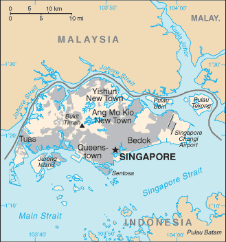
Map and Photos Bukit Prigi Kling


Comments

--- There are no comments yet ---


Add a new comment:


You have to log in to add a comment!


Members area


Register

Forgot password?

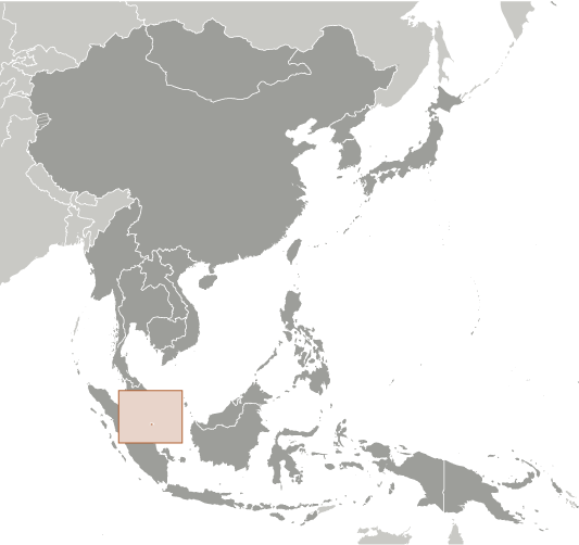
Singapore (City-state):

Advertisement


GPS points near Bukit Prigi Kling


square Selat Biola (0.5km)


square Barn-eiland (0.5km)

square Pulau Senang (0.5km)


square Pulau Biola (0.5km)

square Rabbit Islet (0.5km)

square Biola (0.5km)

square Pemalang (0.5km)

square Telok Ratai (0.5km)

square Pulau Senang (0.5km)


square Coney Islet (1 km)

square Pulau Satumu (1 km)


GPS points from Singapore (City-state)

square Queen Astrid Park Singapore (general)

square Bukit Tinggi Singapore (general)

square Southern Tuas Basin Singapore (general)

square Sungai Pinang Singapore (general)

square Huat Choe Singapore (general)

square Lower Seletar Reservoir Singapore (general)

square Albert Dock Singapore (general)

square Labrador Nature Reserve Singapore (general)


viewweather.com sv.ViewWeather.com
fr.ViewWeather.com
da.ViewWeather.com
de.ViewWeather.com
es.ViewWeather.com
www.carpati.org
www.searchromania.net
Deblocari usi
es.getamap.org
fr.getamap.org
de.getamap.org
nl.getamap.org
da.getamap.org
www.getamap.org
Links
Terms of use
Privacy policy

# 0.0619 sec 

contact AT getamap.net

© 2006 - 2024  https://www.getamap.net/