|

Administrative divisions (GPS Maps)
Geography
People and Society
Government
Economy
Communications
Transportation
Military |
 |
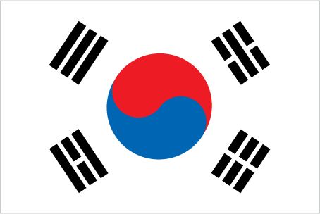
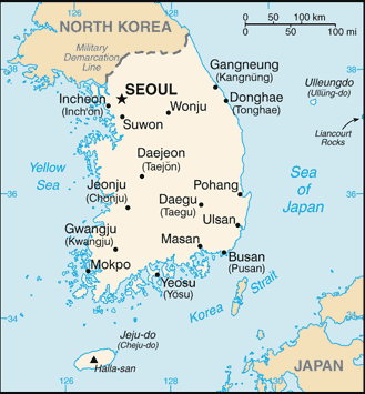
 An independent kingdom for much of its long history, Korea was occupied by Japan beginning in 1905 following the Russo-Japanese War. In 1910, Tokyo formally annexed the entire Peninsula. Korea regained its independence following Japan's surrender to the United States in 1945. After World War II, a democratic-based government (Republic of Korea, ROK) was set up in the southern half of the Korean Peninsula while a Communist-style government was installed in the north (the DPRK). During the Korean War (1950-53), US troops and UN forces fought alongside soldiers from the ROK to defend South Korea from DPRK attacks supported by China and the Soviet Union. An armistice was signed in 1953, splitting the peninsula along a demilitarized zone at about the 38th parallel. Thereafter, South Korea under the PARK Chung-hee regime achieved rapid economic growth with per capita income rising to roughly 17 times the level of North Korea. In 1993, KIM Young-sam became South Korea's first civilian president following 32 years of military rule. South Korea today is a fully functioning modern democracy. President LEE Myung-bak has pursued a policy of global engagement since taking office in February 2008, highlighted by Seoul's hosting of the G-20 summit in November 2010 and the Nuclear Security Summit in March 2012, as well as the forthcoming 2018 Winter Olympic Games. Serious tensions with North Korea have punctuated inter-Korean relations in recent years, including the North's sinking of the South Korean warship Cheonan in March 2010 and its artillery attack on South Korean soldiers and citizens in November 2010. An independent kingdom for much of its long history, Korea was occupied by Japan beginning in 1905 following the Russo-Japanese War. In 1910, Tokyo formally annexed the entire Peninsula. Korea regained its independence following Japan's surrender to the United States in 1945. After World War II, a democratic-based government (Republic of Korea, ROK) was set up in the southern half of the Korean Peninsula while a Communist-style government was installed in the north (the DPRK). During the Korean War (1950-53), US troops and UN forces fought alongside soldiers from the ROK to defend South Korea from DPRK attacks supported by China and the Soviet Union. An armistice was signed in 1953, splitting the peninsula along a demilitarized zone at about the 38th parallel. Thereafter, South Korea under the PARK Chung-hee regime achieved rapid economic growth with per capita income rising to roughly 17 times the level of North Korea. In 1993, KIM Young-sam became South Korea's first civilian president following 32 years of military rule. South Korea today is a fully functioning modern democracy. President LEE Myung-bak has pursued a policy of global engagement since taking office in February 2008, highlighted by Seoul's hosting of the G-20 summit in November 2010 and the Nuclear Security Summit in March 2012, as well as the forthcoming 2018 Winter Olympic Games. Serious tensions with North Korea have punctuated inter-Korean relations in recent years, including the North's sinking of the South Korean warship Cheonan in March 2010 and its artillery attack on South Korean soldiers and citizens in November 2010. |
|
Advertisements
|
Advertisements
|
Administrative divisions (44,694 GPS Maps)
Cheju-do
(940)
|
Cholla-bukto
(1,637)
|
Cholla-namdo
(9,910)
|
Ch ungch ong-bukto
(1,911)
|
Ch ungch ong-namdo
(4,604)
|
Inch on-gwangyoksi
(1,234)
|
Kangwon-do
(3,993)
|
Kwangju-gwangyoksi
(412)
|
Kyonggi-do
(2,989)
|
Kyongsang-bukto
(5,005)
|
Kyongsang-namdo
(5,053)
|
Pusan-gwangyoksi
(687)
|
Soul-t ukpyolsi
(463)
|
South Korea (general)
(4,859)
|
Taegu-gwangyoksi
(361)
|
Taejon-gwangyoksi
(169)
|
Ulsan-gwangyoksi
(467)
|
--- There are no comments yet ---
Add a new comment:
|
Advertisement
Members area
South Korea (Seoul):
GPS points from South Korea (Seoul)
|


