25°10'0" N
76°13'60" W
~0m asl
19:40 (EDT - UTC/GMT--4)
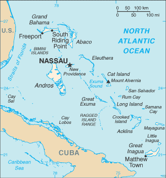
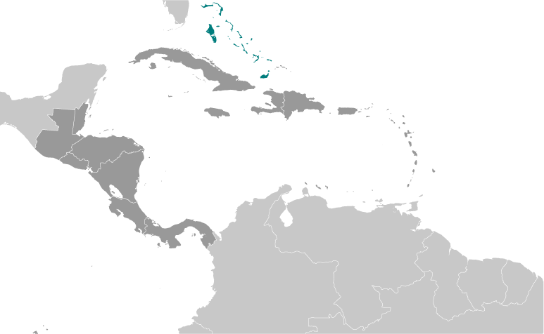
Ile Eleuthera (Ile Eleuthera) is a island (class T - Hypsographic) in Governor's Harbour District (Governor's Harbour), The Bahamas (North America) with the region font code of Americas/Western Europe...
Ile Eleuthera is also known as Governor Harbor, Governor Harbour, Governor's Harbour, Governors Harbor, Governor’s Harbour.
Its coordinates are 25°10'0" N and 76°13'60" W in DMS (Degrees Minutes Seconds) or 25.1667 and -76.2333 (in decimal degrees). Its UTM position is UN78 and its Joint Operation Graphics reference is NG18-10.
Current local time is 19:40; the sun rises at 07:54 and sets at 20:01 local time (America/Nassau UTC/GMT-4). The standard time zone for Ile Eleuthera is UTC/GMT-5, but since Daylight Saving Time (DST) is in effect the current time zone is UTC/GMT-4.
In 2024 DST starts on 10 Mar 2024 and ends on 3 Nov 2024.
A Island is a tract of land, smaller than a continent, surrounded by water at high water.
|
Advertisements:
Advertisements:
|
Weather Ile Eleuthera (Cloud cover, Temperature, Wind speed and Precipitation mm probab.)
Tue
Apr 23
~1 l/m2 40%
22 °C min
24 °C max
36 km/h
Thu Jan 1
|
Wed
Apr 24
21 °C min
23 °C max
23 km/h
Thu Jan 1
|
Thu
Apr 25
22 °C min
24 °C max
27 km/h
Thu Jan 1
|
Fri
Apr 26
22 °C min
24 °C max
35 km/h
Thu Jan 1
|
Sat
Apr 27
23 °C min
24 °C max
39 km/h
Thu Jan 1
|
Sun
Apr 28
~1 l/m2 43%
23 °C min
24 °C max
38 km/h
Thu Jan 1
|
|
|
Governor's Harbour (Governor's Harbour District) 7 day forecast
Map and Photos Ile Eleuthera
--- There are no comments yet ---
Add a new comment:
|
Members area
The Bahamas (Nassau):
Advertisement
GPS points near Ile Eleuthera
GPS points from The Bahamas (Nassau)
|

 Bakers Bluff (1 km)
  Long Point (1 km)
  Laughing Bird Cay (2 km)
  Pigeon Cay (2 km)
  Cupids Cay (3 km)
  Colebrooke Dale (4 km)
  Colebrooke Town (4 km)
  The Cay (4 km)
  White Bluff (4 km)
  North Palmetto Point (5 km)
  North Palmetto Point... (5 km)
  South Palmetto Point (5 km)
  South Palmetto Point... (5 km)
  Bluff Cay (5 km)
  Sinky Bay (5 km)
  Tear Coat Cay (5 km)
  Thomas George Point (5 km)


