|
|
|
Advertisements:
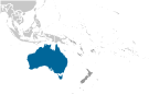
GeographyLocation
Oceania, continent between the Indian Ocean and the South Pacific Ocean Geographic coordinates
27 00 S, 133 00 E
Map references
Oceania
Area World Ranking: 6
Total 7,741,220 sq km
Land 7,682,300 sq km Water 58,920 sq km Note Includes Lord Howe Island and Macquarie Island Area - comparative
Slightly smaller than the US contiguous 48 states Land boundaries
0 km
Coastline
25,760 km
Maritime claims
Territorial sea 12 nm
Contiguous zone 24 nm Exclusive economic zone 200 nm Continental shelf 200 nm or to the edge of the continental margin Climate
Generally arid to semiarid; temperate in south and east; tropical in north Terrain
Mostly low plateau with deserts; fertile plain in southeast Elevation extremes
Lowest point Lake Eyre -15 m
Highest point Mount Kosciuszko 2,229 m Natural resources
Bauxite, coal, iron ore, copper, tin, gold, silver, uranium, nickel, tungsten, rare earth elements, mineral sands, lead, zinc, diamonds, natural gas, petroleum Note Australia is the world's largest net exporter of coal accounting for 29% of global coal exports Land use
Arable land
6.15% (includes about 27 million hectares of cultivated grassland) Permanent crops 0.04%Other 93.81% (2005) Irrigated land
25,500 sq km (2003)
Total renewable water resources
398 cu km (1995)
Freshwater withdrawal (domestic/industrial/agricultural)
Total 24.06 cu km/yr (15%/10%/75%)
Per capita 1,193 cu m/yr (2000) Natural hazards
Cyclones along the coast; severe droughts; forest fires Volcanism Volcanic activity on Heard and McDonald Islands Environment - current issues
Soil erosion from overgrazing, industrial development, urbanization, and poor farming practices; soil salinity rising due to the use of poor quality water; desertification; clearing for agricultural purposes threatens the natural habitat of many unique animal and plant species; the Great Barrier Reef off the northeast coast, the largest coral reef in the world, is threatened by increased shipping and its popularity as a tourist site; limited natural freshwater resources Environment - international agreements
Party to
Antarctic-Environmental Protocol, Antarctic-Marine Living Resources, Antarctic Seals, Antarctic Treaty, Biodiversity, Climate Change, Climate Change-Kyoto Protocol, Desertification, Endangered Species, Environmental Modification, Hazardous Wastes, Law of the Sea, Marine Dumping, Marine Life Conservation, Ozone Layer Protection, Ship Pollution, Tropical Timber 83, Tropical Timber 94, Wetlands, Whaling Signed, but not ratified None of the selected agreements Geography - note
World's smallest continent but sixth-largest country; the only continent without glaciers; population concentrated along the eastern and southeastern coasts; the invigorating sea breeze known as the "Fremantle Doctor" affects the city of Perth on the west coast and is one of the most consistent winds in the world
Comments
Add a new comment: |
Advertisement
Members area
Australia (Canberra):
 
GPS points from Australia (Canberra)
|
||||||||

 Aboriginal settlers arrived on the continent from Southeast Asia about 40,000 years before the first Europeans began exploration in the 17th century. No formal territorial claims were made until 1770, when Capt. James COOK took possession of the east coast in the name of Great Britain (all of Australia was claimed as British territory in 1829 with the creation of the colony of Western Australia). Six colonies were created in the late 18th and 19th centuries; they federated and became the Commonwealth of Australia in 1901. The new country took advantage of its natural resources to rapidly develop agricultural and manufacturing industries and to make a major contribution to the British effort in World Wars I and II. In recent decades, Australia has transformed itself into an internationally competitive, advanced market economy. It boasted one of the OECD's fastest growing economies during the 1990s, a performance due in large part to economic reforms adopted in the 1980s. Long-term concerns include ageing of the population, pressure on infrastructure, and environmental issues such as frequent droughts.