|
|
|
Advertisements:
TransportationAirports World Ranking: 138
18 (2012)
Airports - with paved runways
Total 16
Over 3,047 m 2 2,438 to 3,047 m 2 1,524 to 2,437 m 6 914 to 1,523 m 2 Under 914 m 4 (2012) Airports - with unpaved runways
Total 2
1,524 to 2,437 m 1 Under 914 m 1 (2012) Heliports
3 (2012)
Pipelines
Gas 2,714 km (2010)
Railways World Ranking: 64
Total 2,622 km
Broad gauge 946 km 1.676-m gauge Narrow gauge 1,676 km 1.000-m gauge (2008) Roadways World Ranking: 21
Total 239,226 km
Paved 22,726 km Unpaved 216,500 km (2003) Waterways World Ranking: 17
8,370 km (includes up to 3,060 km of main cargo routes; the network is reduced to 5,200 km in the dry season) (2011) Merchant marine World Ranking: 64
Total 62
By type Bulk carrier 25, cargo 28, chemical tanker 1, container 5, petroleum tanker 3 Foreign-owned 8 (China 1, Singapore 7)Registered in other countries 10 (Comoros 1, Hong Kong 1, Panama 5, Saint Vincent and the Grenadines 1, Sierra Leone 1, Singapore 1) (2010) Ports and terminals
Chittagong, Mongla Port
Transportation - note
The International Maritime Bureau reports the territorial waters of Bangladesh remain a high risk for armed robbery against ships; attacks against vessels increased in 2010 for the second consecutive year; 23 commercial vessels were attacked both at anchor and while underway; crews were robbed and stores or cargoes stolen
Comments
Add a new comment: |
Advertisement
Members area
Bangladesh (Dhaka):
 
GPS points from Bangladesh (Dhaka)
|
||||||||

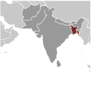 Europeans began to set up trading posts in the area of Bangladesh in the 16th century; eventually the British came to dominate the region and it became part of British India. In 1947, West Pakistan and East Bengal (both primarily Muslim) separated from India (largely Hindu) and jointly became the new country of Pakistan. East Bengal became East Pakistan in 1955, but the awkward arrangement of a two-part country with its territorial units separated by 1,600 km left the Bengalis marginalized and dissatisfied. East Pakistan seceded from its union with West Pakistan in 1971 and was renamed Bangladesh. A military-backed, emergency caretaker regime suspended parliamentary elections planned for January 2007 in an effort to reform the political system and root out corruption. In contrast to the strikes and violent street rallies that had marked Bangladeshi politics in previous years, the parliamentary elections finally held in late December 2008 were mostly peaceful and Sheikh HASINA Wajed was elected prime minister. About a third of this extremely poor country floods annually during the monsoon rainy season, hampering economic development.