|
|
|
Advertisements:
GeographyLocation
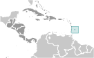
Caribbean, island in the North Atlantic Ocean, northeast of Venezuela Geographic coordinates
13 10 N, 59 32 W
Map references
Central America and the Caribbean
Area World Ranking: 201
Total 430 sq km
Land 430 sq km Water 0 sq km Area - comparative
2.5 times the size of Washington, DC Land boundaries
0 km
Coastline
97 km
Maritime claims
Territorial sea 12 nm
Exclusive economic zone 200 nm Climate
Tropical; rainy season (June to October) Terrain
Relatively flat; rises gently to central highland region Elevation extremes
Lowest point Atlantic Ocean 0 m
Highest point Mount Hillaby 336 m Natural resources
Petroleum, fish, natural gas
Land use
Arable land 37.21%
Permanent crops 2.33% Other 60.46% (2005) Irrigated land
50 sq km (2003)
Total renewable water resources
0.1 cu km (2003)
Freshwater withdrawal (domestic/industrial/agricultural)
Total 0.09 cu km/yr (33%/44%/22%)
Per capita 333 cu m/yr (2000) Natural hazards
Infrequent hurricanes; periodic landslides Environment - current issues
Pollution of coastal waters from waste disposal by ships; soil erosion; illegal solid waste disposal threatens contamination of aquifers Environment - international agreements
Party to
Biodiversity, Climate Change, Climate Change-Kyoto Protocol, Desertification, Endangered Species, Hazardous Wastes, Law of the Sea, Marine Dumping, Ozone Layer Protection, Ship Pollution, Wetlands Signed, but not ratified None of the selected agreements Geography - note
Easternmost Caribbean island
Comments
Add a new comment: |
Advertisement
Members area
Barbados (Bridgetown):
 
GPS points from Barbados (Bridgetown)
|
||||||||

 The island was uninhabited when first settled by the British in 1627. Slaves worked the sugar plantations established on the island until 1834 when slavery was abolished. The economy remained heavily dependent on sugar, rum, and molasses production through most of the 20th century. The gradual introduction of social and political reforms in the 1940s and 1950s led to complete independence from the UK in 1966. In the 1990s, tourism and manufacturing surpassed the sugar industry in economic importance.