|
|
|
Advertisements:
GovernmentCountry name
Conventional long form Republic of Botswana
Conventional short form Botswana Local long form Republic of Botswana Local short form Botswana Former Bechuanaland Government type
Parliamentary republic
Capital
Name Gaborone
Geographic coordinates 24 38 S, 25 54 E Time difference UTC+2 (7 hours ahead of Washington, DC during Standard Time) Administrative divisions
9 districts and 5 town councils*; Central, Francistown*, Gaborone*, Ghanzi, Jwaneng*, Kgalagadi, Kgatleng, Kweneng, Lobatse*, North East, North West, Selebi-Pikwe*, South East, Southern Independence
30 September 1966 (from the UK) National holiday
Independence Day (Botswana Day), 30 September (1966) Constitution
March 1965; effective 30 September 1966 Legal system
Mixed legal system of civil law influenced by the Roman-Dutch model and also customary and common law International law organization participation
Accepts compulsory ICJ jurisdiction with reservations; accepts ICCt jurisdiction Suffrage
18 years of age; universal
Executive branch
Chief of state
President Seretse Khama Ian KHAMA (since 1 April 2008); Vice President Mompati MERAFHE (since 1 April 2008); note - the president is both the chief of state and head of government Head of government President Seretse Khama Ian KHAMA (since 1 April 2008); Vice President Mompati MERAFHE (since 1 April 2008) Cabinet Cabinet appointed by the president Elections President indirectly elected for a five-year term (eligible for a second term); election last held on 20 October 2009 (next to be held in October 2014); vice president appointed by the president Election results Seretse Khama Ian KHAMA elected president; percent of National Assembly vote - NA Legislative branch
Bicameral Parliament consists of the House of Chiefs (a largely advisory 35-member body with 8 ex-officio members consisting of the chiefs of the principal tribes, and 27 non-permanent members serving 5-year terms, of which 22 are indirectly elected with the remaining 5 appointed by the President) and the National Assembly (63 seats; 57 members directly elected by popular vote, 4 appointed by the majority party, and 2, the President and Attorney General, serve as ex-officio members; members serve five-year terms) Elections National Assembly elections last held on 16 October 2009 (next to be held in 2014) Election results Percent of vote by party - BDP 53.3%, BNF 21.9%, BCP 19.2%, 2.3%, other 3.3%; seats by party - BDP 45, BNF 6, BCP 4, BAM 1, other 1 Judicial branch
High Court; Court of Appeal; Magistrates' Courts (one in each district) Political parties and leaders
Botswana Alliance Movement or BAM [Ephraim Lepetu SETSHWAELO]; Botswana Congress Party or BCP [Gilson SALESHANDO]; Botswana Democratic Party or BDP [Daniel KWELAGOBE]; Botswana Movement for Democracy or BMD [Gomolemo MOTSWALEDI]; Botswana National Front or BNF [Otswoletse MOUPO]; Botswana Peoples Party or BPP [Bernard BALIKANI]; MELS Movement of Botswana or MELS [Themba JOINA]; New Democratic Front or NDF [Dick BAYFORD] Note A number of minor parties joined forces in 1999 to form the BAM but did not capture any parliamentary seats - includes the United Action Party [Ephraim Lepetu SETSHWAELO]; the Independence Freedom Party or IFP [Motsamai MPHO]; the Botswana Progressive Union [D. K. KWELE] Political pressure groups and leaders
First People of the Kalahari (Bushman organization); Pitso Ya Ba Tswana; Society for the Promotion of Ikalanga Language (Kalanga elites) Other Diamond mining companiesInternational organization participation
ACP, AfDB, AU, C, FAO, G-77, IAEA, IBRD, ICAO, ICRM, IDA, IFAD, IFC, IFRCS, ILO, IMF, Interpol, IOC, IOM, IPU, ISO, ITSO, ITU, ITUC, MIGA, NAM, OPCW, SACU, SADC, UN, UNCTAD, UNESCO, UNIDO, UNWTO, UPU, WCO, WFTU, WHO, WIPO, WMO, WTO Diplomatic representation in the us
Chief of mission
Ambassador Tabelelo Mazile SERETSE Chancery 1531-1533 New Hampshire Avenue NW, Washington, DC 20036 Telephone [1] (202) 244-4990FAX [1] (202) 244-4164 Diplomatic representation from the us
Chief of mission Ambassador Michelle D. GAVIN
Embassy Embassy Enclave (off Khama Crescent), Gaborone Mailing address Embassy Enclave, P. O. Box 90, Gaborone Telephone [267] 395-3982FAX [267] 395-6947 Flag description
Light blue with a horizontal white-edged black stripe in the center; the blue symbolizes water in the form of rain, while the black and white bands represent racial harmony National symbol(s)
Zebra
National anthem
Name
"Fatshe leno la rona" (Our Land) Lyrics/music Kgalemang Tumedisco MOTSETENote Adopted 1966
Comments
Add a new comment: |
Advertisement
Members area
Botswana (Gaborone):
 
GPS points from Botswana (Gaborone)
|
||||||||

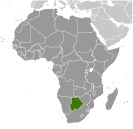 Formerly the British protectorate of Bechuanaland, Botswana adopted its new name upon independence in 1966. Four decades of uninterrupted civilian leadership, progressive social policies, and significant capital investment have created one of the most dynamic economies in Africa. Mineral extraction, principally diamond mining, dominates economic activity, though tourism is a growing sector due to the country's conservation practices and extensive nature preserves. Botswana has one of the world's highest known rates of HIV/AIDS infection, but also one of Africa's most progressive and comprehensive programs for dealing with the disease.