|
|
|
Advertisements:
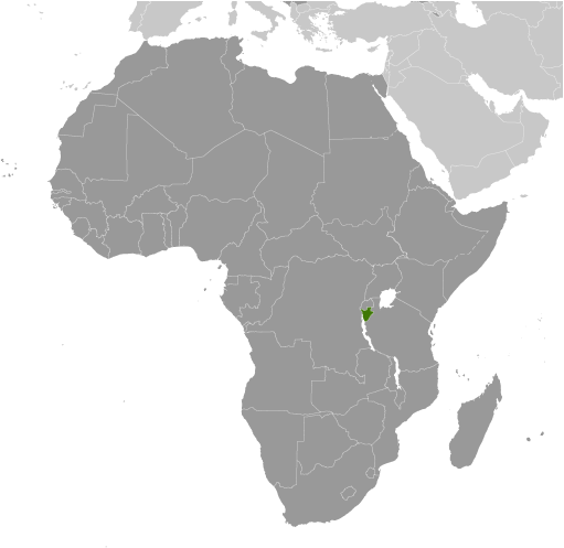
GeographyLocation
Central Africa, east of Democratic Republic of the Congo Geographic coordinates
3 30 S, 30 00 E
Map references
Africa
Area World Ranking: 147
Total 27,830 sq km
Land 25,680 sq km Water 2,150 sq km Area - comparative
Slightly smaller than Maryland
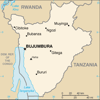
Land boundaries
Total 974 km
Border countries Democratic Republic of the Congo 233 km, Rwanda 290 km, Tanzania 451 km Coastline
0 km (landlocked)
Maritime claims
None (landlocked)
Climate
Equatorial; high plateau with considerable altitude variation (772 m to 2,670 m above sea level); average annual temperature varies with altitude from 23 to 17 degrees centigrade but is generally moderate as the average altitude is about 1,700 m; average annual rainfall is about 150 cm; two wet seasons (February to May and September to November), and two dry seasons (June to August and December to January) Terrain
Hilly and mountainous, dropping to a plateau in east, some plains Elevation extremes
Lowest point Lake Tanganyika 772 m
Highest point Heha 2,670 m Natural resources
Nickel, uranium, rare earth oxides, peat, cobalt, copper, platinum, vanadium, arable land, hydropower, niobium, tantalum, gold, tin, tungsten, kaolin, limestone Land use
Arable land 35.57%
Permanent crops 13.12% Other 51.31% (2005) Irrigated land
230 sq km (2003)
Total renewable water resources
3.6 cu km (1987)
Freshwater withdrawal (domestic/industrial/agricultural)
Total 0.29 cu km/yr (17%/6%/77%)
Per capita 38 cu m/yr (2000) Natural hazards
Flooding; landslides; drought
Environment - current issues
Soil erosion as a result of overgrazing and the expansion of agriculture into marginal lands; deforestation (little forested land remains because of uncontrolled cutting of trees for fuel); habitat loss threatens wildlife populations Environment - international agreements
Party to
Biodiversity, Climate Change, Climate Change-Kyoto Protocol, Desertification, Endangered Species, Hazardous Wastes, Ozone Layer Protection, Wetlands Signed, but not ratified Law of the SeaGeography - note
Landlocked; straddles crest of the Nile-Congo watershed; the Kagera, which drains into Lake Victoria, is the most remote headstream of the White Nile
Comments
Add a new comment: |
Advertisement
Members area
Burundi (Bujumbura):
GPS points from Burundi (Bujumbura)
|
||||||||
 Burundi's first democratically elected president was assassinated in October 1993 after only 100 days in office, triggering widespread ethnic violence between Hutu and Tutsi factions. More than 200,000 Burundians perished during the conflict that spanned almost a dozen years. Hundreds of thousands of Burundians were internally displaced or became refugees in neighboring countries. An internationally brokered power-sharing agreement between the Tutsi-dominated government and the Hutu rebels in 2003 paved the way for a transition process that led to an integrated defense force, established a new constitution in 2005, and elected a majority Hutu government in 2005. The government of President Pierre NKURUNZIZA, who was reelected in 2010, continues to face many political and economic challenges.