|
|
|
Advertisements:
TransportationAirports World Ranking: 112
34 (2012)
Airports - with paved runways
Total 11
Over 3,047 m 2 2,438 to 3,047 m 5 1,524 to 2,437 m 3 914 to 1,523 m 1 (2012) Airports - with unpaved runways
Total 23
1,524 to 2,437 m 3 914 to 1,523 m 13 Under 914 m 7 (2012) Pipelines
Oil 886 km (2010)
Railways World Ranking: 88
Total 987 km
Narrow gauge 987 km 1.000-m gauge (2008) Roadways World Ranking: 80
Total 51,000 km
Paved 5,100 km Unpaved 45,000 km (2004) Waterways
(major rivers in the south, such as the Wouri and the Sanaga, are largely non-navigable; in the north, the Benue, which connects through Nigeria to the Niger River, is navigable in the rainy season only to the port of Garoua) (2010) Ports and terminals
Douala, Garoua, Limboh Terminal
Comments
Add a new comment: |
Advertisement
Members area
Cameroon (Yaounde):
 
GPS points from Cameroon (Yaounde)
|
||||||||

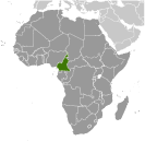 French Cameroon became independent in 1960 as the Republic of Cameroon. The following year the southern portion of neighboring British Cameroon voted to merge with the new country to form the Federal Republic of Cameroon. In 1972, a new constitution replaced the federation with a unitary state, the United Republic of Cameroon. The country has generally enjoyed stability, which has permitted the development of agriculture, roads, and railways, as well as a petroleum industry. Despite slow movement toward democratic reform, political power remains firmly in the hands of President Paul BIYA.