|
|
|
Advertisements:
GeographyLocation
Western Africa, group of islands in the North Atlantic Ocean, west of Senegal Geographic coordinates
16 00 N, 24 00 W
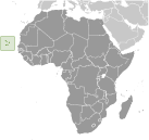
Map references
Africa
Area World Ranking: 176
Total 4,033 sq km
Land 4,033 sq km Water 0 sq km Area - comparative
Slightly larger than Rhode Island Land boundaries
0 km
Coastline
965 km
Maritime claims
Measured from claimed archipelagic baselines Territorial sea 12 nmContiguous zone 24 nm Exclusive economic zone 200 nm Climate
Temperate; warm, dry summer; precipitation meager and erratic Terrain
Steep, rugged, rocky, volcanic
Elevation extremes
Lowest point Atlantic Ocean 0 m
Highest point Mt. Fogo 2,829 m (a volcano on Fogo Island) Natural resources
Salt, basalt rock, limestone, kaolin, fish, clay, gypsum Land use
Arable land 11.41%
Permanent crops 0.74% Other 87.85% (2005) Irrigated land
30 sq km (2003)
Total renewable water resources
0.3 cu km (1990)
Freshwater withdrawal (domestic/industrial/agricultural)
Total 0.02 cu km/yr (7%/2%/91%)
Per capita 39 cu m/yr (2000) Natural hazards
Prolonged droughts; seasonal harmattan wind produces obscuring dust; volcanically and seismically active Volcanism Fogo (elev. 2,829 m), which last erupted in 1995, is Cape Verde's only active volcano Environment - current issues
Soil erosion; deforestation due to demand for wood used as fuel; water shortages; desertification; environmental damage has threatened several species of birds and reptiles; illegal beach sand extraction; overfishing Environment - international agreements
Party to
Biodiversity, Climate Change, Climate Change-Kyoto Protocol, Desertification, Endangered Species, Environmental Modification, Hazardous Wastes, Law of the Sea, Marine Dumping, Ozone Layer Protection, Ship Pollution, Wetlands Signed, but not ratified None of the selected agreements Geography - note
Strategic location 500 km from west coast of Africa near major north-south sea routes; important communications station; important sea and air refueling site
Comments
Add a new comment: |
Advertisement
Members area
Cape Verde (Praia):
 
GPS points from Cape Verde (Praia)
|
||||||||

 The uninhabited islands were discovered and colonized by the Portuguese in the 15th century; Cape Verde subsequently became a trading center for African slaves and later an important coaling and resupply stop for whaling and transatlantic shipping. Following independence in 1975, and a tentative interest in unification with Guinea-Bissau, a one-party system was established and maintained until multi-party elections were held in 1990. Cape Verde continues to exhibit one of Africa's most stable democratic governments. Repeated droughts during the second half of the 20th century caused significant hardship and prompted heavy emigration. As a result, Cape Verde's expatriate population is greater than its domestic one. Most Cape Verdeans have both African and Portuguese antecedents.