|

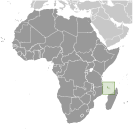
Administrative divisions (GPS Maps)
Geography
People and Society
Government
Economy
Communications
Transportation
Military |
 |
 Comoros has endured more than 20 coups or attempted coups since gaining independence from France in 1975. In 1997, the islands of Anjouan and Moheli declared independence from Comoros. In 1999, military chief Col. AZALI seized power in a bloodless coup, and helped negotiate the 2000 Fomboni Accords power-sharing agreement in which the federal presidency rotates among the three islands, and each island maintains its local government. AZALI won the 2002 presidential election, and each island in the archipelago elected its president. AZALI stepped down in 2006 and President SAMBI was elected to office. In 2007, Mohamed BACAR effected Anjouan's de-facto secession from the Union, refusing to step down in favor of fresh Anjouanais elections when Comoros' other islands held legitimate elections in July. The African Union (AU) initially attempted to resolve the political crisis by applying sanctions and a naval blockade on Anjouan, but in March 2008 AU and Comoran soldiers seized the island. The move was generally welcomed by the island's inhabitants. Comoros has endured more than 20 coups or attempted coups since gaining independence from France in 1975. In 1997, the islands of Anjouan and Moheli declared independence from Comoros. In 1999, military chief Col. AZALI seized power in a bloodless coup, and helped negotiate the 2000 Fomboni Accords power-sharing agreement in which the federal presidency rotates among the three islands, and each island maintains its local government. AZALI won the 2002 presidential election, and each island in the archipelago elected its president. AZALI stepped down in 2006 and President SAMBI was elected to office. In 2007, Mohamed BACAR effected Anjouan's de-facto secession from the Union, refusing to step down in favor of fresh Anjouanais elections when Comoros' other islands held legitimate elections in July. The African Union (AU) initially attempted to resolve the political crisis by applying sanctions and a naval blockade on Anjouan, but in March 2008 AU and Comoran soldiers seized the island. The move was generally welcomed by the island's inhabitants. |
|
Advertisements
|
Advertisements
|
Airports World Ranking: 186
4 (2012)
Airports - with paved runways
Total 4
2,438 to 3,047 m 1
914 to 1,523 m 3 (2012)
Roadways World Ranking: 184
Total 880 km
Paved 673 km
Unpaved 207 km (2002)
Merchant marine World Ranking: 39
Total 149 By type Bulk carrier 16, cargo 83, carrier 5, chemical tanker 5, container 2, passenger 2, passenger/cargo 1, petroleum tanker 17, refrigerated cargo 10, roll on/roll off 8 Foreign-owned 73 (Bangladesh 1, Bulgaria 4, China 1, Cyprus 2, Greece 4, Kenya 2, Kuwait 1, Latvia 2, Lebanon 2, Lithuania 1, Nigeria 1, Norway 1, Pakistan 5, Russia 12, Syria 5, Turkey 8, UAE 8, UK 1, Ukraine 10, US 2) (2010)
Ports and terminals
Mayotte, Mutsamudu
--- There are no comments yet ---
Add a new comment:
|
Advertisement
Members area
Comoros (Moroni):
GPS points from Comoros (Moroni)
|

