|
|
|
Advertisements:
TransportationAirports World Ranking: 145
15 (2012)
Airports - with paved runways
Total 13
2,438 to 3,047 m 6 1,524 to 2,437 m 3 914 to 1,523 m 3 Under 914 m 1 (2012) Airports - with unpaved runways
Total 2
Under 914 m 2 (2012) Heliports
9 (2012)
Pipelines
Oil 0 km
Roadways World Ranking: 122
Total 14,671 km
12,321 km under government control (includes 257 km of expressways), 2,350 km administered by Turkish Cypriots (2008) Merchant marine World Ranking: 13
Total 838
By type Bulk carrier 278, cargo 163, chemical tanker 77, container 201, liquefied gas 11, passenger 3, passenger/cargo 25, petroleum tanker 62, refrigerated cargo 5, roll on/roll off 9, vehicle carrier 4 Foreign-owned 622 (Angola 1, Austria 1, Belgium 3, Bermuda 1, Canada 2, China 6, Denmark 6, Estonia 6, France 16, Germany 192, Greece 201, Hong Kong 2, India 4, Iran 10, Ireland 3, Italy 6, Japan 16, Netherlands 23, Norway 14, Philippines 1, Poland 24, Portugal 2, Russia 46, Singapore 1, Slovenia 5, Spain 6, Sweden 5, Turkey 1, UAE 3, UK 7, Ukraine 3, US 5) Registered in other countries 152 (Bahamas 23, Cambodia 4, Comoros 2, Finland 1, Gibraltar 1, Greece 3, Hong Kong 3, Liberia 9, Malta 32, Marshall Islands 40, Norway 1, Panama 5, Russia 13, Saint Vincent and the Grenadines 3, Sierra Leone 2, Singapore 6, unknown 4) (2010) Ports and terminals
Area under government control: Larnaca, Limassol, Vasilikos; area administered by Turkish Cypriots: Famagusta, Kyrenia
Comments
Add a new comment: |
Advertisement
Members area
Cyprus (Nicosia):
 
GPS points from Cyprus (Nicosia)
|
||||||||

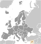 A former British colony, Cyprus became independent in 1960 following years of resistance to British rule. Tensions between the Greek Cypriot majority and Turkish Cypriot minority came to a head in December 1963, when violence broke out in the capital of Nicosia. Despite the deployment of UN peacekeepers in 1964, sporadic intercommunal violence continued forcing most Turkish Cypriots into enclaves throughout the island. In 1974, a Greek Government-sponsored attempt to seize control of Cyprus was met by military intervention from Turkey, which soon controlled more than a third of the island. In 1983, the Turkish Cypriot-occupied area declared itself the "Turkish Republic of Northern Cyprus" ("TRNC"), but it is recognized only by Turkey. The election of a new Cypriot president in 2008 served as the impetus for the UN to encourage both the Greek Cypriot and Turkish Cypriot communities to reopen unification negotiations. In September 2008, the leaders of the two communities began negotiations under UN auspices aimed at reuniting the divided island. The talks are ongoing and the leaders continue to meet regularly. The entire island entered the EU on 1 May 2004, although the EU acquis - the body of common rights and obligations - applies only to the areas under the internationally recognized government, and is suspended in the areas administered by Turkish Cypriots. However, individual Turkish Cypriots able to document their eligibility for Republic of Cyprus citizenship legally enjoy the same rights accorded to other citizens of European Union states.