|
|
|
Advertisements:
TransportationAirports World Ranking: 153
13 (2012)
Airports - with paved runways
Total 3
Over 3,047 m 1 2,438 to 3,047 m 1 1,524 to 2,437 m 1 (2012) Airports - with unpaved runways
Total 10
1,524 to 2,437 m 1 914 to 1,523 m 7 Under 914 m 2 (2012) Railways World Ranking: 126
Total
100 km (Djibouti segment of the 781 km Addis Ababa-Djibouti railway) Narrow gauge 100 km 1.000-m gaugeNote Railway is under joint control of Djibouti and Ethiopia but is largely inoperable (2008) Roadways World Ranking: 165
Total 3,065 km
Paved 1,226 km Unpaved 1,839 km (2000) Ports and terminals
Djibouti
Transportation - note
The International Maritime Bureau reports offshore waters in the Gulf of Aden are high risk for piracy; numerous vessels, including commercial shipping and pleasure craft, have been attacked and hijacked both at anchor and while underway; crew, passengers, and cargo are held for ransom; the presence of several naval task forces in the Gulf of Aden and additional anti-piracy measures on the part of ship operators reduced the incidence of piracy in that body of water by more than half in 2010
Comments
Add a new comment: |
Advertisement
Members area
Djibouti (Djibouti City):
 
GPS points from Djibouti (Djibouti City)
|
||||||||

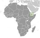 The French Territory of the Afars and the Issas became Djibouti in 1977. Hassan Gouled APTIDON installed an authoritarian one-party state and proceeded to serve as president until 1999. Unrest among the Afars minority during the 1990s led to a civil war that ended in 2001 following the conclusion of a peace accord between Afar rebels and the Issa-dominated government. In 1999, Djibouti's first multi-party presidential elections resulted in the election of Ismail Omar GUELLEH; he was re-elected to a second term in 2005. Djibouti occupies a strategic geographic location at the mouth of the Red Sea and serves as an important transshipment location for goods entering and leaving the east African highlands. The present leadership favors close ties to France, which maintains a significant military presence in the country, but also has strong ties with the US. Djibouti hosts the only US military base in sub-Saharan Africa.