|

Administrative divisions (GPS Maps)
Geography
People and Society
Government
Economy
Communications
Transportation
Military |
 |
 The Portuguese began to trade with the island of Timor in the early 16th century and colonized it in mid-century. Skirmishing with the Dutch in the region eventually resulted in an 1859 treaty in which Portugal ceded the western portion of the island. Imperial Japan occupied Portuguese Timor from 1942 to 1945, but Portugal resumed colonial authority after the Japanese defeat in World War II. East Timor declared itself independent from Portugal on 28 November 1975 and was invaded and occupied by Indonesian forces nine days later. It was incorporated into Indonesia in July 1976 as the province of Timor Timur (East Timor). An unsuccessful campaign of pacification followed over the next two decades, during which an estimated 100,000 to 250,000 individuals lost their lives. On 30 August 1999, in a UN-supervised popular referendum, an overwhelming majority of the people of Timor-Leste voted for independence from Indonesia. However, in the next three weeks, anti-independence Timorese militias - organized and supported by the Indonesian military - commenced a large-scale, scorched-earth campaign of retribution. The militias killed approximately 1,400 Timorese and forcibly pushed 300,000 people into western Timor as refugees. Most of the country's infrastructure, including homes, irrigation systems, water supply systems, and schools, and nearly 100% of the country's electrical grid were destroyed. On 20 September 1999, Australian-led peacekeeping troops deployed to the country and brought the violence to an end. On 20 May 2002, Timor-Leste was internationally recognized as an independent state. In 2006, internal tensions threatened the new nation's security when a military strike led to violence and a breakdown of law and order. At Dili's request, an Australian-led International Stabilization Force (ISF) deployed to Timor-Leste, and the UN Security Council established the UN Integrated Mission in Timor-Leste (UNMIT), which included an authorized police presence of over 1,600 personnel. The ISF and UNMIT restored stability, allowing for presidential and parliamentary elections in 2007 in a largely peaceful atmosphere. In February 2008, a rebel group staged an unsuccessful attack against the president and prime minister. The ringleader was killed in the attack and most of the rebels surrendered in April 2008. Since the unsuccessful attacks the government has enjoyed one of its longest periods of post-independence stability. The Portuguese began to trade with the island of Timor in the early 16th century and colonized it in mid-century. Skirmishing with the Dutch in the region eventually resulted in an 1859 treaty in which Portugal ceded the western portion of the island. Imperial Japan occupied Portuguese Timor from 1942 to 1945, but Portugal resumed colonial authority after the Japanese defeat in World War II. East Timor declared itself independent from Portugal on 28 November 1975 and was invaded and occupied by Indonesian forces nine days later. It was incorporated into Indonesia in July 1976 as the province of Timor Timur (East Timor). An unsuccessful campaign of pacification followed over the next two decades, during which an estimated 100,000 to 250,000 individuals lost their lives. On 30 August 1999, in a UN-supervised popular referendum, an overwhelming majority of the people of Timor-Leste voted for independence from Indonesia. However, in the next three weeks, anti-independence Timorese militias - organized and supported by the Indonesian military - commenced a large-scale, scorched-earth campaign of retribution. The militias killed approximately 1,400 Timorese and forcibly pushed 300,000 people into western Timor as refugees. Most of the country's infrastructure, including homes, irrigation systems, water supply systems, and schools, and nearly 100% of the country's electrical grid were destroyed. On 20 September 1999, Australian-led peacekeeping troops deployed to the country and brought the violence to an end. On 20 May 2002, Timor-Leste was internationally recognized as an independent state. In 2006, internal tensions threatened the new nation's security when a military strike led to violence and a breakdown of law and order. At Dili's request, an Australian-led International Stabilization Force (ISF) deployed to Timor-Leste, and the UN Security Council established the UN Integrated Mission in Timor-Leste (UNMIT), which included an authorized police presence of over 1,600 personnel. The ISF and UNMIT restored stability, allowing for presidential and parliamentary elections in 2007 in a largely peaceful atmosphere. In February 2008, a rebel group staged an unsuccessful attack against the president and prime minister. The ringleader was killed in the attack and most of the rebels surrendered in April 2008. Since the unsuccessful attacks the government has enjoyed one of its longest periods of post-independence stability. |
|
Advertisements
|
Advertisements
|
Location
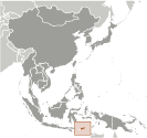
Southeastern Asia, northwest of Australia in the Lesser Sunda Islands at the eastern end of the Indonesian archipelago; note - Timor-Leste includes the eastern half of the island of Timor, the Oecussi (Ambeno) region on the northwest portion of the island of Timor, and the islands of Pulau Atauro and Pulau Jaco
Geographic coordinates
8 50 S, 125 55 E
Map references
Area World Ranking: 160
Total 14,874 sq km
Land 14,874 sq km
Water 0 sq km
Area - comparative
Slightly larger than Connecticut
Land boundaries
Total 228 km
Border countries Indonesia 228 km
Coastline
706 km
Maritime claims
Territorial sea 12 nm
Contiguous zone 24 nm
Exclusive fishing zone 200 nm
Climate
Tropical; hot, humid; distinct rainy and dry seasons
Terrain
Mountainous
Elevation extremes
Lowest point Timor Sea, Savu Sea, and Banda Sea 0 m Highest point Foho Tatamailau 2,963 m
Natural resources
Gold, petroleum, natural gas, manganese, marble
Land use
Arable land 8.2%
Permanent crops 4.57%
Other 87.23% (2005)
Irrigated land
140 sq km
Natural hazards
Floods and landslides are common; earthquakes; tsunamis; tropical cyclones
Environment - current issues
Widespread use of slash and burn agriculture has led to deforestation and soil erosion
Environment - international agreements
Party to Biodiversity, Climate Change, Climate Change-Kyoto Protocol, Desertification Signed, but not ratified None of the selected agreements
Geography - note
Timor comes from the Malay word for "East"; the island of Timor is part of the Malay Archipelago and is the largest and easternmost of the Lesser Sunda Islands
--- There are no comments yet ---
Add a new comment:
|
Advertisement
Members area
East Timor:
GPS points from East Timor
 Daro East Timor (general)
Unafa East Timor (general)
|
