|
|
|
Advertisements:
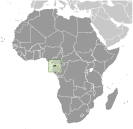
GeographyLocation
Central Africa, bordering the Bight of Biafra, between Cameroon and Gabon Geographic coordinates
2 00 N, 10 00 E
Map references
Africa
Area World Ranking: 146
Total 28,051 sq km
Land 28,051 sq km Water 0 sq km Area - comparative
Slightly smaller than Maryland
Land boundaries
Total 539 km
Border countries Cameroon 189 km, Gabon 350 km Coastline
296 km
Maritime claims
Territorial sea 12 nm
Exclusive economic zone 200 nm Climate
Tropical; always hot, humid
Terrain
Coastal plains rise to interior hills; islands are volcanic Elevation extremes
Lowest point Atlantic Ocean 0 m
Highest point Pico Basile 3,008 m Natural resources
Petroleum, natural gas, timber, gold, bauxite, diamonds, tantalum, sand and gravel, clay Land use
Arable land 4.63%
Permanent crops 3.57% Other 91.8% (2005) Irrigated land
NA
Total renewable water resources
26 cu km (2001)
Freshwater withdrawal (domestic/industrial/agricultural)
Total 0.11 cu km/yr (83%/16%/1%)
Per capita 220 cu m/yr (2000) Natural hazards
Violent windstorms; flash floods Volcanism Santa Isabel (elev. 3,007 m), which last erupted in 1923, is the country's only historically active volcano; Santa Isabel, along with two dormant volcanoes, form Bioko Island in the Gulf of Guinea Environment - current issues
Tap water is not potable; deforestation Environment - international agreements
Party to
Biodiversity, Climate Change, Climate Change-Kyoto Protocol, Desertification, Endangered Species, Hazardous Wastes, Law of the Sea, Marine Dumping, Ozone Layer Protection, Ship Pollution, Wetlands Signed, but not ratified None of the selected agreements Geography - note
Insular and continental regions widely separated
Comments
Add a new comment: |
Advertisement
Members area
Equatorial Guinea (Malabo):
 
GPS points from Equatorial Guinea (Malabo)
|
||||||||

 Equatorial Guinea gained independence in 1968 after 190 years of Spanish rule. This tiny country, composed of a mainland portion plus five inhabited islands, is one of the smallest on the African continent. President Teodoro OBIANG NGUEMA MBASOGO has ruled the country since 1979 when he seized power in a coup. Although nominally a constitutional democracy since 1991, the 1996, 2002, and 2009 presidential elections - as well as the 1999, 2004, and 2008 legislative elections - were widely seen as flawed. The president exerts almost total control over the political system and has discouraged political opposition. Equatorial Guinea has experienced rapid economic growth due to the discovery of large offshore oil reserves, and in the last decade has become Sub-Saharan Africa's third largest oil exporter. Despite the country's economic windfall from oil production resulting in a massive increase in government revenue in recent years, improvements in the population's living standards have been slow to develop.