|
|
|
Advertisements:
TransportationAirports World Ranking: 152
13 (2012)
Airports - with paved runways
Total 4
Over 3,047 m 2 2,438 to 3,047 m 2 (2012) Airports - with unpaved runways
Total 9
Over 3,047 m 1 2,438 to 3,047 m 1 1,524 to 2,437 m 5 914 to 1,523 m 2 (2012) Heliports
1 (2012)
Railways World Ranking: 119
Total 306 km
Narrow gauge 306 km 0.950-m gauge (2008) Roadways World Ranking: 157
Total 4,010 km
Paved 874 km Unpaved 3,136 km (2000) Merchant marine World Ranking: 129
Total 4
By type Cargo 2, petroleum tanker 1, roll on/roll off 1 (2010) Ports and terminals
Assab, Massawa
Comments
Add a new comment: |
Advertisement
Members area
Eritrea (Asmara):
 
GPS points from Eritrea (Asmara)
|
||||||||

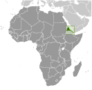 The UN awarded Eritrea to Ethiopia in 1952 as part of a federation. Ethiopia's annexation of Eritrea as a province 10 years later sparked a 30-year struggle for independence that ended in 1991 with Eritrean rebels defeating governmental forces; independence was overwhelmingly approved in a 1993 referendum. A two-and-a-half-year border war with Ethiopia that erupted in 1998 ended under UN auspices in December 2000. Eritrea hosted a UN peacekeeping operation that monitored a 25 km-wide Temporary Security Zone (TSZ) on the border with Ethiopia. Eritrea's denial of fuel to the mission caused the UN to withdraw the mission and terminate its mandate 31 July 2008. An international commission, organized to resolve the border dispute, posted its findings in 2002. However, both parties have been unable to reach agreement on implementing the decision. On 30 November 2007, the Eritrea-Ethiopia Boundary Commission remotely demarcated the border by coordinates and dissolved itself, leaving Ethiopia still occupying several tracts of disputed territory, including the town of Badme. Eritrea accepted the EEBC's "virtual demarcation" decision and called on Ethiopia to remove its troops from the TSZ that it states is Eritrean territory. Ethiopia has not accepted the virtual demarcation decision. In 2009 the UN imposed sanctions on Eritrea after accusing it of backing anti-Ethiopian Islamist insurgents in Somalia.