|
|
|
Advertisements:
TransportationAirports World Ranking: 61
98 (2012)
Airports - with paved runways
Total 11
1,524 to 2,437 m 2 914 to 1,523 m 1 Under 914 m 8 (2012) Airports - with unpaved runways
Total 87
914 to 1,523 m 13 Under 914 m 74 (2012) Roadways World Ranking: 142
Total 7,970 km
Paved 590 km Unpaved 7,380 km (2000) Waterways World Ranking: 92
330 km (the Berbice, Demerara, and Essequibo rivers are navigable by oceangoing vessels for 150 km, 100 km, and 80 km respectively) (2012) Merchant marine World Ranking: 114
Total 10
By type Cargo 7, petroleum tanker 2, refrigerated cargo 1 Registered in other countries 3 (Saint Vincent and the Grenadines 2, unknown 1) (2010) Ports and terminals
Georgetown
Comments
Add a new comment: |
Advertisement
Members area
Guyana (Georgetown):
 
GPS points from Guyana (Georgetown)
|
||||||||

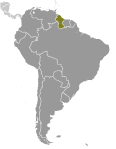 Originally a Dutch colony in the 17th century, by 1815 Guyana had become a British possession. The abolition of slavery led to black settlement of urban areas and the importation of indentured servants from India to work the sugar plantations. This ethnocultural divide has persisted and has led to turbulent politics. Guyana achieved independence from the UK in 1966, and since then it has been ruled mostly by socialist-oriented governments. In 1992, Cheddi JAGAN was elected president in what is considered the country's first free and fair election since independence. After his death five years later, his wife, Janet JAGAN, became president but resigned in 1999 due to poor health. Her successor, Bharrat JAGDEO, was reelected in 2001 and again in 2006. Donald RAMOTAR was elected president in 2011.