|
|
|
Advertisements:
GeographyLocation
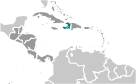
Caribbean, western one-third of the island of Hispaniola, between the Caribbean Sea and the North Atlantic Ocean, west of the Dominican Republic Geographic coordinates
19 00 N, 72 25 W
Map references
Central America and the Caribbean
Area World Ranking: 148
Total 27,750 sq km
Land 27,560 sq km Water 190 sq km Area - comparative
Slightly smaller than Maryland
Land boundaries
Total 360 km
Border countries Dominican Republic 360 km Coastline
1,771 km
Maritime claims
Territorial sea 12 nm
Contiguous zone 24 nm Exclusive economic zone 200 nm Continental shelf To depth of exploitation Climate
Tropical; semiarid where mountains in east cut off trade winds Terrain
Mostly rough and mountainous
Elevation extremes
Lowest point Caribbean Sea 0 m
Highest point Chaine de la Selle 2,680 m Natural resources
Bauxite, copper, calcium carbonate, gold, marble, hydropower Land use
Arable land 28.11%
Permanent crops 11.53% Other 60.36% (2005) Irrigated land
920 sq km (2003)
Total renewable water resources
14 cu km (2000)
Freshwater withdrawal (domestic/industrial/agricultural)
Total 0.99 cu km/yr (5%/1%/94%)
Per capita 116 cu m/yr (2000) Natural hazards
Lies in the middle of the hurricane belt and subject to severe storms from June to October; occasional flooding and earthquakes; periodic droughts Environment - current issues
Extensive deforestation (much of the remaining forested land is being cleared for agriculture and used as fuel); soil erosion; inadequate supplies of potable water Environment - international agreements
Party to
Biodiversity, Climate Change, Climate Change-Kyoto Protocol, Desertification, Law of the Sea, Marine Dumping, Marine Life Conservation, Ozone Layer Protection Signed, but not ratified Hazardous WastesGeography - note
Shares island of Hispaniola with Dominican Republic (western one-third is Haiti, eastern two-thirds is the Dominican Republic)
Comments
Add a new comment: |
Advertisement
Members area
Haiti (Port-au-prince):
 
GPS points from Haiti (Port-au-prince)
|
||||||||

 The native Taino Amerindians - who inhabited the island of Hispaniola when it was discovered by Christopher COLUMBUS in 1492 - were virtually annihilated by Spanish settlers within 25 years. In the early 17th century, the French established a presence on Hispaniola. In 1697, Spain ceded to the French the western third of the island, which later became Haiti. The French colony, based on forestry and sugar-related industries, became one of the wealthiest in the Caribbean but only through the heavy importation of African slaves and considerable environmental degradation. In the late 18th century, Haiti's nearly half million slaves revolted under Toussaint L'OUVERTURE. After a prolonged struggle, Haiti became the first black republic to declare independence in 1804. The poorest country in the Western Hemisphere, Haiti has been plagued by political violence for most of its history. After an armed rebellion led to the forced resignation and exile of President Jean-Bertrand ARISTIDE in February 2004, an interim government took office to organize new elections under the auspices of the United Nations. Continued violence and technical delays prompted repeated postponements, but Haiti finally did inaugurate a democratically elected president and parliament in May of 2006. A massive magnitude 7.0 earthquake struck Haiti in January 2010 with an epicenter about 25 km (15 mi) west of the capital, Port-au-Prince. Over 300,000 people were killed and some 1 milllion left homeless. The earthquake was assessed as the worst in this region over the last 200 years.