|
|
|
Advertisements:
TransportationAirports World Ranking: 104
41 (2012)
Airports - with paved runways
Total 20
Over 3,047 m 2 2,438 to 3,047 m 6 1,524 to 2,437 m 5 914 to 1,523 m 6 Under 914 m 1 (2012) Airports - with unpaved runways
Total 21
1,524 to 2,437 m 2 914 to 1,523 m 8 Under 914 m 11 (2012) Heliports
3 (2012)
Pipelines
Gas 4,716 km; oil 984 km; refined products 361 km (2010) Railways World Ranking: 26
Total 8,057 km
Broad gauge 36 km 1.524-m gauge Standard gauge 7,802 km 1.435-m gauge (2,911 km electrified) Narrow gauge 219 km 0.760-m gauge (2009)Roadways World Ranking: 25
Total 197,519 km
Paved 74,993 km (43,898 km of interurban roads including 911 km of expressways) Unpaved 112,526 km (2010)Waterways World Ranking: 48
1,622 km (most on Danube River) (2011) Ports and terminals
Budapest, Dunaujvaros, Gyor-Gonyu, Csepel, Baja, Mohacs
Comments
Add a new comment: |
Advertisement
Members area
Hungary (Budapest):
 
GPS points from Hungary (Budapest)
|
||||||||

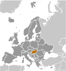 Hungary became a Christian kingdom in A.D. 1000 and for many centuries served as a bulwark against Ottoman Turkish expansion in Europe. The kingdom eventually became part of the polyglot Austro-Hungarian Empire, which collapsed during World War I. The country fell under Communist rule following World War II. In 1956, a revolt and an announced withdrawal from the Warsaw Pact were met with a massive military intervention by Moscow. Under the leadership of Janos KADAR in 1968, Hungary began liberalizing its economy, introducing so-called "Goulash Communism." Hungary held its first multiparty elections in 1990 and initiated a free market economy. It joined NATO in 1999 and the EU five years later. In 2011, Hungary assumed the six-month rotating presidency of the EU for the first time.