|
|
|
Advertisements:
GeographyLocation
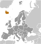
Northern Europe, island between the Greenland Sea and the North Atlantic Ocean, northwest of the United Kingdom Geographic coordinates
65 00 N, 18 00 W
Map references
Europe
Area World Ranking: 108
Total 103,000 sq km
Land 100,250 sq km Water 2,750 sq km Area - comparative
Slightly smaller than Kentucky
Land boundaries
0 km
Coastline
4,970 km
Maritime claims
Territorial sea 12 nm
Exclusive economic zone 200 nm Continental shelf 200 nm or to the edge of the continental margin Climate
Temperate; moderated by North Atlantic Current; mild, windy winters; damp, cool summers Terrain
Mostly plateau interspersed with mountain peaks, icefields; coast deeply indented by bays and fiords Elevation extremes
Lowest point Atlantic Ocean 0 m
Highest point Hvannadalshnukur 2,110 m (at Vatnajokull glacier) Natural resources
Fish, hydropower, geothermal power, diatomite Land use
Arable land 0.07%
Permanent crops 0% Other 99.93% (2005) Irrigated land
NA
Total renewable water resources
170 cu km (2005)
Freshwater withdrawal (domestic/industrial/agricultural)
Total 0.17 cu km/yr (34%/66%/0%)
Per capita 567 cu m/yr (2003) Natural hazards
Earthquakes and volcanic activity Volcanism Iceland, situated on top of a hotspot, experiences severe volcanic activity; Eyjafjallajokull (elev. 1,666 m) erupted in 2010, sending ash high into the atmosphere and seriously disrupting European air traffic; scientists continue to monitor nearby Katla (elev. 1,512 m), which has a high probability of eruption in the very near future, potentially disrupting air traffic; Grimsvoetn and Hekla are Iceland's most active volcanoes; other historically active volcanoes include Askja, Bardarbunga, Brennisteinsfjoll, Esjufjoll, Hengill, Krafla, Krisuvik, Kverkfjoll, Oraefajokull, Reykjanes, Torfajokull, and Vestmannaeyjar Environment - current issues
Water pollution from fertilizer runoff; inadequate wastewater treatment Environment - international agreements
Party to
Air Pollution, Air Pollution-Persistent Organic Pollutants, Biodiversity, Climate Change, Climate Change-Kyoto Protocol, Desertification, Endangered Species, Hazardous Wastes, Kyoto Protocol, Law of the Sea, Marine Dumping, Ozone Layer Protection, Ship Pollution, Transboundary Air Pollution, Wetlands, Whaling Signed, but not ratified Environmental Modification, Marine Life Conservation Geography - note
Strategic location between Greenland and Europe; westernmost European country; Reykjavik is the northernmost national capital in the world; more land covered by glaciers than in all of continental Europe
Comments
Add a new comment: |
Advertisement
Members area
Iceland (Reykjavik):
 
GPS points from Iceland (Reykjavik)
|
||||||||

 Settled by Norwegian and Celtic (Scottish and Irish) immigrants during the late 9th and 10th centuries A.D., Iceland boasts the world's oldest functioning legislative assembly, the Althing, established in 930. Independent for over 300 years, Iceland was subsequently ruled by Norway and Denmark. Fallout from the Askja volcano of 1875 devastated the Icelandic economy and caused widespread famine. Over the next quarter century, 20% of the island's population emigrated, mostly to Canada and the US. Denmark granted limited home rule in 1874 and complete independence in 1944. The second half of the 20th century saw substantial economic growth driven primarily by the fishing industry. The economy diversified greatly after the country joined the European Economic Area in 1994, but Iceland was especially hard hit by the global financial crisis in the years following 2008. Literacy, longevity, and social cohesion are first rate by world standards.