|
|
|
Advertisements:
GeographyLocation
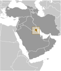
Middle East, bordering the Persian Gulf, between Iraq and Saudi Arabia Geographic coordinates
29 30 N, 45 45 E
Map references
Middle East
Area World Ranking: 158
Total 17,818 sq km
Land 17,818 sq km Water 0 sq km Area - comparative
Slightly smaller than New Jersey Land boundaries
Total 462 km
Border countries Iraq 240 km, Saudi Arabia 222 km Coastline
499 km
Maritime claims
Territorial sea 12 nm
Climate
Dry desert; intensely hot summers; short, cool winters Terrain
Flat to slightly undulating desert plain Elevation extremes
Lowest point Persian Gulf 0 m
Highest point Unnamed elevation 306 m Natural resources
Petroleum, fish, shrimp, natural gas Land use
Arable land 0.84%
Permanent crops 0.17% Other 98.99% (2005) Irrigated land
100 sq km (2003)
Total renewable water resources
0.02 cu km (1997)
Freshwater withdrawal (domestic/industrial/agricultural)
Total 0.44 cu km/yr (45%/2%/52%)
Per capita 164 cu m/yr (2000) Natural hazards
Sudden cloudbursts are common from October to April and bring heavy rain, which can damage roads and houses; sandstorms and dust storms occur throughout the year but are most common between March and August Environment - current issues
Limited natural freshwater resources; some of world's largest and most sophisticated desalination facilities provide much of the water; air and water pollution; desertification Environment - international agreements
Party to
Biodiversity, Climate Change, Climate Change-Kyoto Protocol, Desertification, Endangered Species, Environmental Modification, Hazardous Wastes, Law of the Sea, Ozone Layer Protection Signed, but not ratified Marine DumpingGeography - note
Strategic location at head of Persian Gulf
Comments
Add a new comment: |
Advertisement
Members area
Kuwait (Kuwait City):
 
GPS points from Kuwait (Kuwait City)
|
||||||||

 Britain oversaw foreign relations and defense for the ruling Kuwaiti AL-SABAH dynasty from 1899 until independence in 1961. Kuwait was attacked and overrun by Iraq on 2 August 1990. Following several weeks of aerial bombardment, a US-led, UN coalition began a ground assault on 23 February 1991 that liberated Kuwait in four days. Kuwait spent more than $5 billion to repair oil infrastructure damaged during 1990-91. The AL-SABAH family has ruled since returning to power in 1991 and reestablished an elected legislature that in recent years has become increasingly assertive. The country witnessed the historic election in May 2009 of four women to its National Assembly. Amid the 2010-11 uprisings and protests across the Arab world, stateless Arabs, known as bidoon, staged small protests in February and March 2011 demanding citizenship, jobs, and other benefits available to Kuwaiti nationals. Youth activist groups - supported by opposition legislators and the prime minister's rivals within the ruling family - rallied in March 2011 for an end to corruption and the ouster of the prime minister and his cabinet. Similar protests continued sporadically throughout April and May. In late September 2011 government inquiries of widespread corruption drew more public anger and renewed calls for the prime minister's removal.