|
|
|
Advertisements:
GeographyLocation
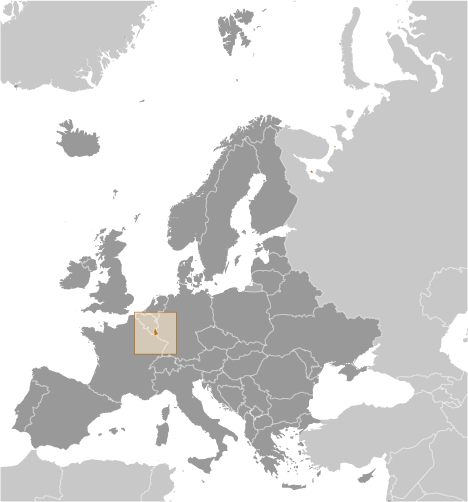
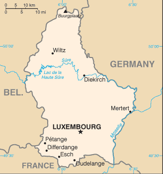
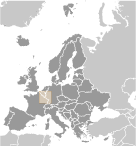
Western Europe, between France and Germany Geographic coordinates
49 45 N, 6 10 E
Map references
Europe
Area World Ranking: 179
Total 2,586 sq km
Land 2,586 sq km Water 0 sq km Area - comparative
Slightly smaller than Rhode Island Land boundaries
Total 359 km
Border countries Belgium 148 km, France 73 km, Germany 138 km Coastline
0 km (landlocked)
Maritime claims
None (landlocked)
Climate
Modified continental with mild winters, cool summers Terrain
Mostly gently rolling uplands with broad, shallow valleys; uplands to slightly mountainous in the north; steep slope down to Moselle flood plain in the southeast Elevation extremes
Lowest point Moselle River 133 m
Highest point Buurgplaatz 559 m Natural resources
Iron ore (no longer exploited), arable land Land use
Arable land 27.42%
Permanent crops 0.69% Other 71.89% (includes Belgium) (2005) Irrigated land
NA
Total renewable water resources
1.6 cu km (2005)
Freshwater withdrawal (domestic/industrial/agricultural)
Total 0.06 cu km/yr (42%/45%/13%)
Per capita 121 cu m/yr (1999) Natural hazards
NA
Environment - current issues
Air and water pollution in urban areas, soil pollution of farmland Environment - international agreements
Party to
Air Pollution, Air Pollution-Nitrogen Oxides, Air Pollution-Persistent Organic Pollutants, Air Pollution-Sulfur 85, Air Pollution-Sulfur 94, Air Pollution-Volatile Organic Compounds, Biodiversity, Climate Change, Climate Change-Kyoto Protocol, Desertification, Endangered Species, Hazardous Wastes, Law of the Sea, Marine Dumping, Ozone Layer Protection, Ship Pollution, Tropical Timber 83, Tropical Timber 94, Wetlands Signed, but not ratified Environmental ModificationGeography - note
Landlocked; the only Grand Duchy in the world
Comments
Add a new comment: |
Advertisement
Members area
Luxembourg (Luxembourg City):
GPS points from Luxembourg (Luxembourg City)
|
||||||||
 Founded in 963, Luxembourg became a grand duchy in 1815 and an independent state under the Netherlands. It lost more than half of its territory to Belgium in 1839 but gained a larger measure of autonomy. Full independence was attained in 1867. Overrun by Germany in both world wars, it ended its neutrality in 1948 when it entered into the Benelux Customs Union and when it joined NATO the following year. In 1957, Luxembourg became one of the six founding countries of the European Economic Community (later the European Union), and in 1999 it joined the euro currency area.