|
|
|
Advertisements:
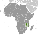
GeographyLocation
Southern Africa, east of Zambia, west and north of Mozambique Geographic coordinates
13 30 S, 34 00 E
Map references
Africa
Area World Ranking: 100
Total 118,484 sq km
Land 94,080 sq km Water 24,404 sq km Area - comparative
Slightly smaller than Pennsylvania Land boundaries
Total 2,881 km
Border countries Mozambique 1,569 km, Tanzania 475 km, Zambia 837 km Coastline
0 km (landlocked)
Maritime claims
None (landlocked)
Climate
Sub-tropical; rainy season (November to May); dry season (May to November) Terrain
Narrow elongated plateau with rolling plains, rounded hills, some mountains Elevation extremes
Lowest point
Junction of the Shire River and international boundary with Mozambique 37 m Highest point Sapitwa (Mount Mlanje) 3,002 mNatural resources
Limestone, arable land, hydropower, unexploited deposits of uranium, coal, and bauxite Land use
Arable land 20.68%
Permanent crops 1.18% Other 78.14% (2005) Irrigated land
590 sq km (2003)
Total renewable water resources
17.3 cu km (2001)
Freshwater withdrawal (domestic/industrial/agricultural)
Total 1.01 cu km/yr (15%/5%/80%)
Per capita 78 cu m/yr (2000) Natural hazards
NA
Environment - current issues
Deforestation; land degradation; water pollution from agricultural runoff, sewage, industrial wastes; siltation of spawning grounds endangers fish populations Environment - international agreements
Party to
Biodiversity, Climate Change, Climate Change-Kyoto Protocol, Desertification, Endangered Species, Environmental Modification, Hazardous Wastes, Marine Life Conservation, Ozone Layer Protection, Ship Pollution, Wetlands Signed, but not ratified Law of the SeaGeography - note
Landlocked; Lake Nyasa, some 580 km long, is the country's most prominent physical feature
Comments
Add a new comment: |
Advertisement
Members area
Malawi (Lilongwe):
 
GPS points from Malawi (Lilongwe)
|
||||||||

 Established in 1891, the British protectorate of Nyasaland became the independent nation of Malawi in 1964. After three decades of one-party rule under President Hastings Kamuzu BANDA the country held multiparty elections in 1994, under a provisional constitution that came into full effect the following year. President Bingu wa MUTHARIKA, elected in May 2004 after a failed attempt by the previous president to amend the constitution to permit another term, struggled to assert his authority against his predecessor and subsequently started his own party, the Democratic Progressive Party (DPP) in 2005. MUTHARIKA was reelected to a second term in May 2009. As president, he oversaw some economic improvement. He died abruptly in April 2012 and was succeeded by his vice president, Joyce BANDA. Population growth, increasing pressure on agricultural lands, corruption, and the spread of HIV/AIDS pose major problems for Malawi.