|
|
|
Advertisements:
CommunicationsTelephones - main lines in use World Ranking: 155
71,600 (2009)
Telephones - mobile cellular World Ranking: 128
2.745 million (2009)
Telephone system
General assessment
Limited system of cable and open-wire lines, minor microwave radio relay links, and radiotelephone communications stations; mobile-cellular services expanding rapidly Domestic Mauritel, the national telecommunications company, was privatized in 2001 but remains the monopoly provider of fixed-line services; fixed-line teledensity 2 per 100 persons; mobile-cellular network coverage extends mainly to urban areas with a teledensity of 85 per 100 persons; mostly cable and open-wire lines; a domestic satellite telecommunications system links Nouakchott with regional capitals International Country code - 222; satellite earth stations - 3 (1 Intelsat - Atlantic Ocean, 2 Arabsat); fiber-optic and Asymmetric Digital Subscriber Line (ADSL) cables for Internet access (2008) Broadcast media
Broadcast media state-owned; 1 state-run TV and 1 state-run radio network; Television de Mauritanie, the state-run TV station, has an additional 6 regional TV stations that provide local programming (2008) Internet country code
.mr
Internet hosts World Ranking: 217
28 (2010)
Internet users World Ranking: 169
75,000 (2009)
Comments
Add a new comment: |
Advertisement
Members area
Mauritania (Nouakchott):
 
GPS points from Mauritania (Nouakchott)
|
||||||||

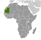 Independent from France in 1960, Mauritania annexed the southern third of the former Spanish Sahara (now Western Sahara) in 1976 but relinquished it after three years of raids by the Polisario guerrilla front seeking independence for the territory. Maaouya Ould Sid Ahmed TAYA seized power in a coup in 1984 and ruled Mauritania with a heavy hand for more than two decades. A series of presidential elections that he held were widely seen as flawed. A bloodless coup in August 2005 deposed President TAYA and ushered in a military council that oversaw a transition to democratic rule. Independent candidate Sidi Ould Cheikh ABDALLAHI was inaugurated in April 2007 as Mauritania's first freely and fairly elected president. His term ended prematurely in August 2008 when a military junta led by General Mohamed Ould Abdel AZIZ deposed him and ushered in a military council government. AZIZ was subsequently elected president in July 2009 and sworn in the following month. The country continues to experience ethnic tensions among its black population (Afro-Mauritanians) and white and black Moor (Arab-Berber) communities, and is having to confront a growing terrorism threat by al-Qa'ida in the Islamic Maghreb (AQIM).