|
|
Advertisements:
TransportationAirports World Ranking: 56
100 (2012)
Airports - with paved runways
Total 21
Over 3,047 m 1 2,438 to 3,047 m 3 1,524 to 2,437 m 9 914 to 1,523 m 4 Under 914 m 4 (2012) Airports - with unpaved runways
Total 79
2,438 to 3,047 m 1 1,524 to 2,437 m 9 914 to 1,523 m 32 Under 914 m 37 (2012) Pipelines
Gas 918 km; refined products 278 km (2010) Railways World Ranking: 38
Total 4,787 km
Narrow gauge 4,787 km 1.067-m gauge (2008) Roadways World Ranking: 97
Total 30,331 km
Paved 6,303 km Unpaved 24,028 km (2000) Waterways World Ranking: 86
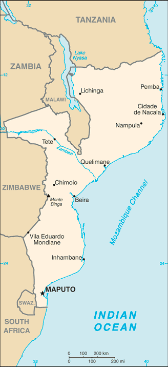
460 km (Zambezi River navigable to Tete and along Cahora Bassa Lake) (2010) Merchant marine World Ranking: 144
Total 2
By type Cargo 2 Foreign-owned 2 (Belgium 2) (2010) Ports and terminals
Beira, Maputo, Nacala
Comments
Add a new comment: |
Advertisement
Members area
Mozambique (Maputo):
 
GPS points from Mozambique (Maputo)
|
||||||||

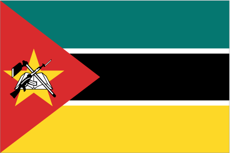
 Almost five centuries as a Portuguese colony came to a close with independence in 1975. Large-scale emigration, economic dependence on South Africa, a severe drought, and a prolonged civil war hindered the country's development until the mid 1990s. The ruling Front for the Liberation of Mozambique (Frelimo) party formally abandoned Marxism in 1989, and a new constitution the following year provided for multiparty elections and a free market economy. A UN-negotiated peace agreement between Frelimo and rebel Mozambique National Resistance (Renamo) forces ended the fighting in 1992. In December 2004, Mozambique underwent a delicate transition as Joaquim CHISSANO stepped down after 18 years in office. His elected successor, Armando Emilio GUEBUZA, promised to continue the sound economic policies that have encouraged foreign investment. President GUEBUZA was reelected to a second term in October 2009. However, the elections were flawed by voter fraud, questionable disqualification of candidates, and Frelimo use of government resources during the campaign. As a result, Freedom House removed Mozambique from its list of electoral democracies.