|
|
Advertisements:
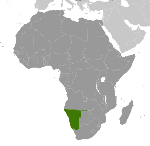
GeographyLocation
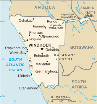
Southern Africa, bordering the South Atlantic Ocean, between Angola and South Africa Geographic coordinates
22 00 S, 17 00 E
Map references
Africa
Area World Ranking: 34
Total 824,292 sq km
Land 823,290 sq km Water 1,002 sq km Area - comparative
Slightly more than half the size of Alaska Land boundaries
Total 3,936 km
Border countries Angola 1,376 km, Botswana 1,360 km, South Africa 967 km, Zambia 233 km Coastline
1,572 km
Maritime claims
Territorial sea 12 nm
Contiguous zone 24 nm Exclusive economic zone 200 nm Climate
Desert; hot, dry; rainfall sparse and erratic Terrain
Mostly high plateau; Namib Desert along coast; Kalahari Desert in east Elevation extremes
Lowest point Atlantic Ocean 0 m
Highest point Konigstein 2,606 m Natural resources
Diamonds, copper, uranium, gold, silver, lead, tin, lithium, cadmium, tungsten, zinc, salt, hydropower, fish Note Suspected deposits of oil, coal, and iron ore Land use
Arable land 0.99%
Permanent crops 0.01% Other 99% (2005) Irrigated land
80 sq km (2003)
Total renewable water resources
45.5 cu km (1991)
Freshwater withdrawal (domestic/industrial/agricultural)
Total 0.3 cu km/yr (24%/5%/71%)
Per capita 148 cu m/yr (2000) Natural hazards
Prolonged periods of drought
Environment - current issues
Limited natural freshwater resources; desertification; wildlife poaching; land degradation has led to few conservation areas Environment - international agreements
Party to
Antarctic-Marine Living Resources, Biodiversity, Climate Change, Climate Change-Kyoto Protocol, Desertification, Endangered Species, Hazardous Wastes, Law of the Sea, Ozone Layer Protection, Wetlands Signed, but not ratified None of the selected agreements Geography - note
First country in the world to incorporate the protection of the environment into its constitution; some 14% of the land is protected, including virtually the entire Namib Desert coastal strip
Comments
Add a new comment: |
Advertisement
Members area
Namibia (Windhoek):
 
GPS points from Namibia (Windhoek)
|
||||||||

 South Africa occupied the German colony of South-West Africa during World War I and administered it as a mandate until after World War II, when it annexed the territory. In 1966 the Marxist South-West Africa People's Organization (SWAPO) guerrilla group launched a war of independence for the area that became Namibia, but it was not until 1988 that South Africa agreed to end its administration in accordance with a UN peace plan for the entire region. Namibia has been governed by SWAPO since the country won independence in 1990. Hifikepunye POHAMBA was elected president in November 2004 in a landslide victory replacing Sam NUJOMA who led the country during its first 14 years of self rule. POHAMBA was reelected in November 2009.