|
|
|
Advertisements:
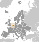
GeographyLocation
Western Europe, bordering the North Sea, between Belgium and Germany Geographic coordinates
52 30 N, 5 45 E
Map references
Europe
Area World Ranking: 135
Total 41,543 sq km
Land 33,893 sq km Water 7,650 sq km Area - comparative
Slightly less than twice the size of New Jersey Land boundaries
Total 1,027 km
Border countries Belgium 450 km, Germany 577 km Coastline
451 km
Maritime claims
Territorial sea 12 nm
Contiguous zone 24 nm Exclusive fishing zone 200 nm Climate
Temperate; marine; cool summers and mild winters Terrain
Mostly coastal lowland and reclaimed land (polders); some hills in southeast Elevation extremes
Lowest point Zuidplaspolder -7 m
Highest point Mount Scenery 862 m (on the island of Saba in the Caribbean, now considered an integral part of the Netherlands following the dissolution of the Netherlands Antilles) Note The highest point on continental Netherlands is Vaalserberg at 322 m Natural resources
Natural gas, petroleum, peat, limestone, salt, sand and gravel, arable land Land use
Arable land 21.96%
Permanent crops 0.77% Other 77.27% (2005) Irrigated land
4,600 sq km (2003)
Total renewable water resources
89.7 cu km (2005)
Freshwater withdrawal (domestic/industrial/agricultural)
Total 8.86 cu km/yr (6%/60%/34%)
Per capita 544 cu m/yr (2001) Natural hazards
Flooding
Environment - current issues
Water pollution in the form of heavy metals, organic compounds, and nutrients such as nitrates and phosphates; air pollution from vehicles and refining activities; acid rain Environment - international agreements
Party to
Air Pollution, Air Pollution-Nitrogen Oxides, Air Pollution-Persistent Organic Pollutants, Air Pollution-Sulfur 85, Air Pollution-Sulfur 94, Air Pollution-Volatile Organic Compounds, Antarctic-Environmental Protocol, Antarctic-Marine Living Resources, Antarctic Treaty, Biodiversity, Climate Change, Climate Change-Kyoto Protocol, Desertification, Endangered Species, Environmental Modification, Hazardous Wastes, Law of the Sea, Marine Dumping, Marine Life Conservation, Ozone Layer Protection, Ship Pollution, Tropical Timber 83, Tropical Timber 94, Wetlands, Whaling Signed, but not ratified None of the selected agreements Geography - note
Located at mouths of three major European rivers (Rhine, Maas or Meuse, and Schelde)
Comments
Add a new comment: |
Advertisement
Members area
Netherlands (Amsterdam):
 
GPS points from Netherlands (Amsterdam)
|
||||||||

 The Dutch United Provinces declared their independence from Spain in 1579; during the 17th century, they became a leading seafaring and commercial power, with settlements and colonies around the world. After a 20-year French occupation, a Kingdom of the Netherlands was formed in 1815. In 1830 Belgium seceded and formed a separate kingdom. The Netherlands remained neutral in World War I, but suffered invasion and occupation by Germany in World War II. A modern, industrialized nation, the Netherlands is also a large exporter of agricultural products. The country was a founding member of NATO and the EEC (now the EU), and participated in the introduction of the euro in 1999. In October 2010, the former Netherlands Antilles was dissolved and the three smallest islands - Bonaire, Sint Eustatius, and Saba - became special municipalities in the Netherlands administrative structure. The larger islands of Sint Maarten and Curacao joined the Netherlands and Aruba as constituent countries forming the Kingdom of the Netherlands.