|
|
|
Advertisements:
TransportationAirports World Ranking: 9
800 (2012)
Airports - with paved runways
Total 15
Over 3,047 m 3 1,524 to 2,437 m 7 914 to 1,523 m 5 (2012) Airports - with unpaved runways
Total 785
1,524 to 2,437 m 23 914 to 1,523 m 289 Under 914 m 473 (2012) Railways World Ranking: 132
Total 36 km
Standard gauge 36 km 1.435-m gauge (2008) Roadways World Ranking: 98
Total 29,500 km
Paved 14,986 km Unpaved 14,514 km (2000) Waterways World Ranking: 33
3,100 km (primarily on the Paraguay and Paraná river systems) (2012) Merchant marine World Ranking: 96
Total 19
By type Cargo 13, container 3, passenger 1, petroleum tanker 1, roll on/roll off 1 Foreign-owned 6 (Argentina 5, Netherlands 1) (2010) Ports and terminals
Asuncion, Villeta, San Antonio, Encarnacion
Comments
Add a new comment: |
Advertisement
Members area
Paraguay (Asuncion):
 
GPS points from Paraguay (Asuncion)
|
||||||||

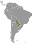 Paraguay achieved its independence from Spain in 1811. In the disastrous War of the Triple Alliance (1865-70) - between Paraguay and Argentina, Brazil, and Uruguay - Paraguay lost two-thirds of all adult males and much of its territory. The country stagnated economically for the next half century. Following the Chaco War of 1932-35 with Bolivia, Paraguay gained a large part of the Chaco lowland region. The 35-year military dictatorship of Alfredo STROESSNER ended in 1989, and, despite a marked increase in political infighting in recent years, Paraguay has held relatively free and regular presidential elections since then.