|
|
|
Advertisements:
TransportationAirports World Ranking: 46
125 (2012)
Airports - with paved runways
Total 86
Over 3,047 m 5 2,438 to 3,047 m 29 1,524 to 2,437 m 37 914 to 1,523 m 9 Under 914 m 6 (2012) Airports - with unpaved runways
Total 39
1,524 to 2,437 m 1 914 to 1,523 m 17 Under 914 m 21 (2012) Heliports
6 (2012)
Pipelines
Gas 13,860 km; oil 1,384 km; refined products 777 km; unknown 35 km (2010) Railways World Ranking: 15
Total 19,428 km
Broad gauge 399 km 1.524-m gauge Standard gauge 19,029 km 1.435-m gauge (11,805 km electrified) (2007) Roadways World Ranking: 15
Total 423,997 km
Paved 295,356 km (includes 765 km of expressways) Unpaved 128,641 km (2008)Waterways World Ranking: 28
3,997 km (navigable rivers and canals) (2009) Merchant marine World Ranking: 118
Total 9
By type Cargo 7, chemical tanker 1, passenger/cargo 1 Registered in other countries 106 (Antigua and Barbuda 2, Bahamas 34, Cyprus 24, Liberia 13, Malta 21, Saint Vincent and the Grenadines 3, Vanuatu 9) (2010) Ports and terminals
Gdansk, Gdynia, Swinoujscie, Szczecin
Comments
Add a new comment: |
Advertisement
Members area
Poland (Warsaw):
 
GPS points from Poland (Warsaw)
|
||||||||

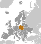 Poland's history as a state begins near the middle of the 10th century. By the mid-16th century, the Polish-Lithuanian Commonwealth ruled a vast tract of land in central and eastern Europe. During the 18th century, internal disorders weakened the nation, and in a series of agreements between 1772 and 1795, Russia, Prussia, and Austria partitioned Poland among themselves. Poland regained its independence in 1918 only to be overrun by Germany and the Soviet Union in World War II. It became a Soviet satellite state following the war, but its government was comparatively tolerant and progressive. Labor turmoil in 1980 led to the formation of the independent trade union "Solidarity" that over time became a political force with over ten million members. Free elections in 1989 and 1990 won Solidarity control of the parliament and the presidency, bringing the Communist era to a close. A "shock therapy" program during the early 1990s enabled the country to transform its economy into one of the most robust in Central Europe. Poland joined NATO in 1999 and the European Union in 2004. With its transformation to a democratic, market-oriented country largely completed, Poland is an increasingly active member of Euro-Atlantic organizations.