|
|
|
Advertisements:
TransportationAirports World Ranking: 129
25 (2012)
Airports - with paved runways
Total 7
Over 3,047 m 2 2,438 to 3,047 m 1 1,524 to 2,437 m 4 (2012) Airports - with unpaved runways
Total 18
1,524 to 2,437 m 8 914 to 1,523 m 9 Under 914 m 1 (2012) Pipelines
Gas 65 km; oil 273 km (2010)
Railways World Ranking: 94
Total 886 km
Narrow gauge 886 km 1.067-m gauge (2008) Roadways World Ranking: 117
Total 17,289 km
Paved 864 km Unpaved 16,425 km (2004) Waterways World Ranking: 62
1,120 km (commercially navigable on Congo and Oubanqui rivers above Brazzaville; there are many ferries across the river to Kinshasa; the Congo south of Brazzaville-Kinshasa to the coast is not navigable because of rapids, thereby necessitating a rail connection to Pointe Noire; other rivers are used for local traffic only) (2011) Merchant marine World Ranking: 148
Registered in other countries
1 (Democratic Republic of the Congo 1) (2010) Ports and terminals
Brazzaville, Djeno, Impfondo, Ouesso, Oyo, Pointe-Noire
Comments
Add a new comment: |
Advertisement
Members area
Republic Of The Congo (Brazzaville):
 
GPS points from Republic Of The Congo (Brazzaville)
|
||||||||

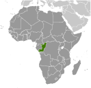 Upon independence in 1960, the former French region of Middle Congo became the Republic of the Congo. A quarter century of experimentation with Marxism was abandoned in 1990 and a democratically elected government took office in 1992. A brief civil war in 1997 restored former Marxist President Denis SASSOU-Nguesso, and ushered in a period of ethnic and political unrest. Southern-based rebel groups agreed to a final peace accord in March 2003, but the calm is tenuous and refugees continue to present a humanitarian crisis. The Republic of Congo was once one of Africa's largest petroleum producers, but with declining production it will need new offshore oil finds to sustain its oil earnings over the long term.