|
|
|
Advertisements:
GeographyLocation
Central Africa, east of Democratic Republic of the Congo Geographic coordinates
2 00 S, 30 00 E
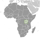
Map references
Africa
Area World Ranking: 149
Total 26,338 sq km
Land 24,668 sq km Water 1,670 sq km Area - comparative
Slightly smaller than Maryland
Land boundaries
Total 893 km
Border countries Burundi 290 km, Democratic Republic of the Congo 217 km, Tanzania 217 km, Uganda 169 km Coastline
0 km (landlocked)
Maritime claims
None (landlocked)
Climate
Temperate; two rainy seasons (February to April, November to January); mild in mountains with frost and snow possible Terrain
Mostly grassy uplands and hills; relief is mountainous with altitude declining from west to east Elevation extremes
Lowest point Rusizi River 950 m
Highest point Volcan Karisimbi 4,519 m Natural resources
Gold, cassiterite (tin ore), wolframite (tungsten ore), methane, hydropower, arable land Land use
Arable land 45.56%
Permanent crops 10.25% Other 44.19% (2005) Irrigated land
90 sq km (2003)
Total renewable water resources
5.2 cu km (2003)
Freshwater withdrawal (domestic/industrial/agricultural)
Total 0.15 cu km/yr (24%/8%/68%)
Per capita 17 cu m/yr (2000) Natural hazards
Periodic droughts; the volcanic Virunga mountains are in the northwest along the border with Democratic Republic of the Congo Volcanism Visoke (elev. 3,711 m), located on the border with the Democratic Republic of the Congo, is the country's only historically active volcano Environment - current issues
Deforestation results from uncontrolled cutting of trees for fuel; overgrazing; soil exhaustion; soil erosion; widespread poaching Environment - international agreements
Party to
Biodiversity, Climate Change, Climate Change-Kyoto Protocol, Desertification, Endangered Species, Hazardous Wastes, Ozone Layer Protection, Wetlands Signed, but not ratified Law of the SeaGeography - note
Landlocked; most of the country is savanna grassland with the population predominantly rural
Comments
Add a new comment: |
Advertisement
Members area
Rwanda (Kigali):
 
GPS points from Rwanda (Kigali)
|
||||||||

 In 1959, three years before independence from Belgium, the majority ethnic group, the Hutus, overthrew the ruling Tutsi king. Over the next several years, thousands of Tutsis were killed, and some 150,000 driven into exile in neighboring countries. The children of these exiles later formed a rebel group, the Rwandan Patriotic Front (RPF), and began a civil war in 1990. The war, along with several political and economic upheavals, exacerbated ethnic tensions, culminating in April 1994 in a state-orchestrated genocide, in which Rwandans killed up to a million of their fellow citizens, including approximately three-quarters of the Tutsi population. The genocide ended later that same year when the predominantly Tutsi RPF, operating out of Uganda and northern Rwanda, defeated the national army and Hutu militias, and established an RPF-led government of national unity. Approximately 2 million Hutu refugees - many fearing Tutsi retribution - fled to neighboring Burundi, Tanzania, Uganda, and Zaire. Since then, most of the refugees have returned to Rwanda, but several thousand remained in the neighboring Democratic Republic of the Congo (DRC, the former Zaire) and formed an extremist insurgency bent on retaking Rwanda, much as the RPF tried in 1990. Rwanda held its first local elections in 1999 and its first post-genocide presidential and legislative elections in 2003. Rwanda in 2009 staged a joint military operation with the Congolese Army in DRC to rout out the Hutu extremist insurgency there and Kigali and Kinshasa restored diplomatic relations. Rwanda also joined the Commonwealth in late 2009.