|
|
|
Advertisements:
GeographyLocation
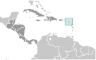
Caribbean, islands in the Caribbean Sea, about one-third of the way from Puerto Rico to Trinidad and Tobago Geographic coordinates
17 20 N, 62 45 W
Map references
Central America and the Caribbean
Area World Ranking: 211
Total
261 sq km (Saint Kitts 168 sq km; Nevis 93 sq km) Land 261 sq kmWater 0 sq km Area - comparative
One and a half times the size of Washington, DC Land boundaries
0 km
Coastline
135 km
Maritime claims
Territorial sea 12 nm
Contiguous zone 24 nm Exclusive economic zone 200 nm Continental shelf 200 nm or to the edge of the continental margin Climate
Tropical, tempered by constant sea breezes; little seasonal temperature variation; rainy season (May to November) Terrain
Volcanic with mountainous interiors Elevation extremes
Lowest point Caribbean Sea 0 m
Highest point Mount Liamuiga 1,156 m Natural resources
Arable land
Land use
Arable land 19.44%
Permanent crops 2.78% Other 77.78% (2005) Irrigated land
0.2 sq km
Total renewable water resources
0.02 cu km (2000)
Natural hazards
Hurricanes (July to October)
Environment - current issues
NA
Environment - international agreements
Party to
Biodiversity, Climate Change, Climate Change-Kyoto Protocol, Desertification, Endangered Species, Hazardous Wastes, Law of the Sea, Marine Dumping, Ozone Layer Protection, Ship Pollution, Whaling Signed, but not ratified None of the selected agreements Geography - note
With coastlines in the shape of a baseball bat and ball, the two volcanic islands are separated by a 3-km-wide channel called The Narrows; on the southern tip of long, baseball bat-shaped Saint Kitts lies the Great Salt Pond; Nevis Peak sits in the center of its almost circular namesake island and its ball shape complements that of its sister island
Comments
Add a new comment: |
Advertisement
Members area
Saint Kitts And Nevis (Basseterre):
 
GPS points from Saint Kitts And Nevis (Basseterre)
|
||||||||

 Carib Indians occupied the islands for hundreds of years before the British began settlement in 1623. The islands became an associated state of the UK with full internal autonomy in 1967. The island of Anguilla rebelled and was allowed to secede in 1971. Saint Kitts and Nevis achieved independence in 1983. In 1998, a vote in Nevis on a referendum to separate from Saint Kitts fell short of the two-thirds majority needed. Nevis continues in its efforts to separate from Saint Kitts.