|
|
Advertisements:
GeographyLocation
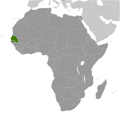
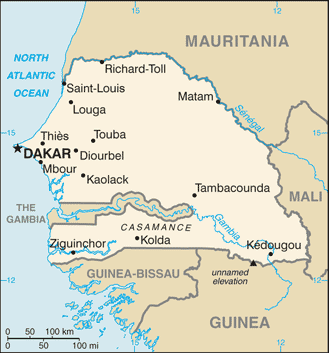
Western Africa, bordering the North Atlantic Ocean, between Guinea-Bissau and Mauritania Geographic coordinates
14 00 N, 14 00 W
Map references
Africa
Area World Ranking: 88
Total 196,722 sq km
Land 192,530 sq km Water 4,192 sq km Area - comparative
Slightly smaller than South Dakota Land boundaries
Total 2,640 km
Border countries The Gambia 740 km, Guinea 330 km, Guinea-Bissau 338 km, Mali 419 km, Mauritania 813 km Coastline
531 km
Maritime claims
Territorial sea 12 nm
Contiguous zone 24 nm Exclusive economic zone 200 nm Continental shelf 200 nm or to the edge of the continental margin Climate
Tropical; hot, humid; rainy season (May to November) has strong southeast winds; dry season (December to April) dominated by hot, dry, harmattan wind Terrain
Generally low, rolling, plains rising to foothills in southeast Elevation extremes
Lowest point Atlantic Ocean 0 m
Highest point Unnamed elevation southwest of Kedougou 581 m Natural resources
Fish, phosphates, iron ore
Land use
Arable land 12.51%
Permanent crops 0.24% Other 87.25% (2005) Irrigated land
1,200 sq km (2003)
Total renewable water resources
39.4 cu km (1987)
Freshwater withdrawal (domestic/industrial/agricultural)
Total 2.22 cu km/yr (4%/3%/93%)
Per capita 190 cu m/yr (2002) Natural hazards
Lowlands seasonally flooded; periodic droughts Environment - current issues
Wildlife populations threatened by poaching; deforestation; overgrazing; soil erosion; desertification; overfishing Environment - international agreements
Party to
Biodiversity, Climate Change, Climate Change-Kyoto Protocol, Desertification, Endangered Species, Hazardous Wastes, Law of the Sea, Marine Life Conservation, Ozone Layer Protection, Ship Pollution, Wetlands, Whaling Signed, but not ratified None of the selected agreements Geography - note
Westernmost country on the African continent; The Gambia is almost an enclave within Senegal
Comments
Add a new comment: |
Advertisement
Members area
Senegal (Dakar):
 
GPS points from Senegal (Dakar)
|
||||||||

 The French colonies of Senegal and the French Sudan were merged in 1959 and granted their independence as the Mali Federation in 1960. The union broke up after only a few months. Senegal joined with The Gambia to form the nominal confederation of Senegambia in 1982. The envisaged integration of the two countries was never carried out, and the union was dissolved in 1989. The Movement of Democratic Forces in the Casamance (MFDC) has led a low-level separatist insurgency in southern Senegal since the 1980s, and several peace deals have failed to resolve the conflict. Nevertheless, Senegal remains one of the most stable democracies in Africa and has a long history of participating in international peacekeeping and regional mediation. Senegal was ruled by a Socialist Party for 40 years until Abdoulaye WADE was elected president in 2000. He was reelected in 2007 and during his two terms amended Senegal's constitution over a dozen times to increase executive power and to weaken the opposition. His attempt to change the constitution in June 2011 prompted large public protests and his decision to run for a third presidential term sparked a large public backlash that led to his defeat in a March 2012 runoff election with Macky SALL.