|
|
|
Advertisements:
GeographyLocation
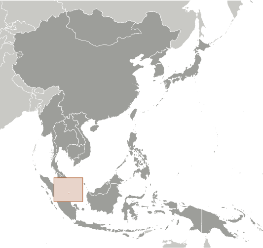
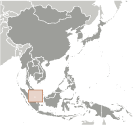
Southeastern Asia, islands between Malaysia and Indonesia Geographic coordinates
1 22 N, 103 48 E
Map references
Southeast Asia
Area World Ranking: 192
Total 697 sq km
Land 687 sq km Water 10 sq km Area - comparative
Slightly more than 3.5 times the size of Washington, DC Land boundaries
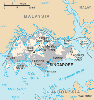
0 km
Coastline
193 km
Maritime claims
Territorial sea 3 nm
Exclusive fishing zone Within and beyond territorial sea, as defined in treaties and practice Climate
Tropical; hot, humid, rainy; two distinct monsoon seasons - Northeastern monsoon (December to March) and Southwestern monsoon (June to September); inter-monsoon - frequent afternoon and early evening thunderstorms Terrain
Lowland; gently undulating central plateau contains water catchment area and nature preserve Elevation extremes
Lowest point Singapore Strait 0 m
Highest point Bukit Timah 166 m Natural resources
Fish, deepwater ports
Land use
Arable land 1.47%
Permanent crops 1.47% Other 97.06% (2005) Irrigated land
NA
Total renewable water resources
0.6 cu km (1975)
Freshwater withdrawal (domestic/industrial/agricultural)
Total 0.19 cu km/yr (45%/51%/4%)
Per capita 44 cu m/yr (1975) Natural hazards
NA
Environment - current issues
Industrial pollution; limited natural freshwater resources; limited land availability presents waste disposal problems; seasonal smoke/haze resulting from forest fires in Indonesia Environment - international agreements
Party to
Biodiversity, Climate Change, Climate Change-Kyoto Protocol, Desertification, Endangered Species, Hazardous Wastes, Law of the Sea, Ozone Layer Protection, Ship Pollution Signed, but not ratified None of the selected agreements Geography - note
Focal point for Southeast Asian sea routes
Comments
Add a new comment: |
Advertisement
Members area
Singapore (City-state):
GPS points from Singapore (City-state)
|
||||||||
 Singapore was founded as a British trading colony in 1819. It joined the Malaysian Federation in 1963 but separated two years later and became independent. Singapore subsequently became one of the world's most prosperous countries with strong international trading links (its port is one of the world's busiest in terms of tonnage handled) and with per capita GDP equal to that of the leading nations of Western Europe.