|
|
|
Advertisements:
TransportationAirports World Ranking: 108
37 (2012)
Airports - with paved runways
Total 19
Over 3,047 m 2 2,438 to 3,047 m 2 1,524 to 2,437 m 3 914 to 1,523 m 3 Under 914 m 9 (2012) Airports - with unpaved runways
Total 18
914 to 1,523 m 10 Under 914 m 8 (2012) Heliports
1 (2012)
Pipelines
Gas 6,769 km; oil 416 km (2010) Railways World Ranking: 48
Total 3,622 km
Broad gauge 99 km 1.520-m gauge Standard gauge 3,473 km 1.435-m gauge (1,615 km electrified) Narrow gauge 50 km 1.000-m or 0.750-m gauge (2008) Roadways World Ranking: 84
Total 43,761 km
Paved 38,085 km (includes 384 km of expressways) Unpaved 5,676 km (2008)Waterways World Ranking: 100
172 km (on Danube River) (2009) Merchant marine World Ranking: 112
Total 11
By type Cargo 9, refrigerated cargo 2 Foreign-owned 11 (Germany 3, Ireland 1, Italy 2, Montenegro 1, Slovenia 1, Turkey 1, Ukraine 2) (2010) Ports and terminals
Bratislava, Komarno
Comments
Add a new comment: |
Advertisement
Members area
Slovakia (Bratislava):
 
GPS points from Slovakia (Bratislava)
|
||||||||

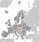 Slovakia's roots can be traced to the 9th century state of Great Moravia. Subsequently, the Slovaks became part of the Hungarian Kingdom, where they remained for the next 1,000 years. Following the formation of the dual Austro-Hungarian monarchy in 1867, language and education policies favoring the use of Hungarian (Magyarization) resulted in a strengthening of Slovak nationalism and a cultivation of cultural ties with the closely related Czechs, who were themselves ruled by the Austrians. After the dissolution of the Austro-Hungarian Empire at the close of World War I, the Slovaks joined the Czechs to form Czechoslovakia. Following the chaos of World War II, Czechoslovakia became a Communist nation within Soviet-dominated Eastern Europe. Soviet influence collapsed in 1989 and Czechoslovakia once more became free. The Slovaks and the Czechs agreed to separate peacefully on 1 January 1993. Slovakia joined both NATO and the EU in the spring of 2004 and the euro area on 1 January 2009.