|
|
|
Advertisements:
CommunicationsTelephones - main lines in use World Ranking: 203
8,400 (2009)
Telephones - mobile cellular World Ranking: 202
30,000 (2009)
Telephone system
General assessment NA
Domestic Mobile-cellular telephone density is about 5 telephones per 100 persons International Country code - 677; satellite earth station - 1 Intelsat (Pacific Ocean) Broadcast media
Solomon Islands Broadcasting Corporation (SIBC) is the sole TV broadcaster with 1 station; multi-channel pay-TV is available; SIBC operates 2 national radio stations and 2 provincial stations; 2 local commercial radio stations; Radio Australia is available via satellite feed (2009) Internet country code
.sb
Internet hosts World Ranking: 147
4,354 (2010)
Internet users World Ranking: 200
10,000 (2009)
Comments
Add a new comment: |
Advertisement
Members area
Solomon Islands (Honiara):
 
GPS points from Solomon Islands (Honiara)
|
||||||||

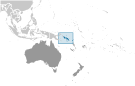 The UK established a protectorate over the Solomon Islands in the 1890s. Some of the most bitter fighting of World War II occurred on this archipelago. Self-government was achieved in 1976 and independence two years later. Ethnic violence, government malfeasance, and endemic crime have undermined stability and civil society. In June 2003, then Prime Minister Sir Allan KEMAKEZA sought the assistance of Australia in reestablishing law and order; the following month, an Australian-led multinational force arrived to restore peace and disarm ethnic militias. The Regional Assistance Mission to the Solomon Islands (RAMSI) has generally been effective in restoring law and order and rebuilding government institutions.