|
|
|
Advertisements:
CommunicationsTelephones - main lines in use World Ranking: 148
85,000 (2009)
Telephones - mobile cellular World Ranking: 154
890,000 (2009)
Telephone system
General assessment
International facilities are good Domestic Combined fixed-line and mobile-cellular teledensity roughly 200 telephones per 100 persons; microwave radio relay network International Country code - 597; satellite earth stations - 2 Intelsat (Atlantic Ocean) Broadcast media
2 state-owned TV stations; 1 state-owned radio station; multiple private radio and TV stations (2007) Internet country code
.sr
Internet hosts World Ranking: 201
186 (2010)
Internet users World Ranking: 146
163,000 (2009)
Comments
Add a new comment: |
Advertisement
Members area
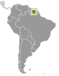
Suriname (Paramaribo):
 
GPS points from Suriname (Paramaribo)
|
||||||||

 First explored by the Spaniards in the 16th century and then settled by the English in the mid-17th century, Suriname became a Dutch colony in 1667. With the abolition of slavery in 1863, workers were brought in from India and Java. Independence from the Netherlands was granted in 1975. Five years later the civilian government was replaced by a military regime that soon declared a socialist republic. It continued to exert control through a succession of nominally civilian administrations until 1987, when international pressure finally forced a democratic election. In 1990, the military overthrew the civilian leadership, but a democratically elected government - a four-party coalition - returned to power in 1991. The coalition expanded to eight parties in 2005 and ruled until August 2010, when voters returned former military leader Desire BOUTERSE and his opposition coalition to power.