|
|
|
Advertisements:
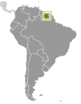
GeographyLocation
Northern South America, bordering the North Atlantic Ocean, between French Guiana and Guyana Geographic coordinates
4 00 N, 56 00 W
Map references
South America
Area World Ranking: 92
Total 163,820 sq km
Land 156,000 sq km Water 7,820 sq km Area - comparative
Slightly larger than Georgia
Land boundaries
Total 1,703 km
Border countries Brazil 593 km, French Guiana 510 km, Guyana 600 km Coastline
386 km
Maritime claims
Territorial sea 12 nm
Exclusive economic zone 200 nm Climate
Tropical; moderated by trade winds Terrain
Mostly rolling hills; narrow coastal plain with swamps Elevation extremes
Lowest point
Unnamed location in the coastal plain -2 m Highest point Juliana Top 1,230 mNatural resources
Timber, hydropower, fish, kaolin, shrimp, bauxite, gold, and small amounts of nickel, copper, platinum, iron ore Land use
Arable land 0.36%
Permanent crops 0.06% Other 99.58% (2005) Irrigated land
510 sq km (2003)
Total renewable water resources
122 cu km (2003)
Freshwater withdrawal (domestic/industrial/agricultural)
Total 0.67 cu km/yr (4%/3%/93%)
Per capita 1,489 cu m/yr (2000) Natural hazards
NA
Environment - current issues
Deforestation as timber is cut for export; pollution of inland waterways by small-scale mining activities Environment - international agreements
Party to
Biodiversity, Climate Change, Climate Change-Kyoto Protocol, Desertification, Endangered Species, Law of the Sea, Marine Dumping, Ozone Layer Protection, Ship Pollution, Tropical Timber 94, Wetlands, Whaling Signed, but not ratified None of the selected agreements Geography - note
Smallest independent country on South American continent; mostly tropical rain forest; great diversity of flora and fauna that, for the most part, is increasingly threatened by new development; relatively small population, mostly along the coast
Comments
Add a new comment: |
Advertisement
Members area
Suriname (Paramaribo):
 
GPS points from Suriname (Paramaribo)
|
||||||||

 First explored by the Spaniards in the 16th century and then settled by the English in the mid-17th century, Suriname became a Dutch colony in 1667. With the abolition of slavery in 1863, workers were brought in from India and Java. Independence from the Netherlands was granted in 1975. Five years later the civilian government was replaced by a military regime that soon declared a socialist republic. It continued to exert control through a succession of nominally civilian administrations until 1987, when international pressure finally forced a democratic election. In 1990, the military overthrew the civilian leadership, but a democratically elected government - a four-party coalition - returned to power in 1991. The coalition expanded to eight parties in 2005 and ruled until August 2010, when voters returned former military leader Desire BOUTERSE and his opposition coalition to power.