|
|
|
Advertisements:
GeographyLocation
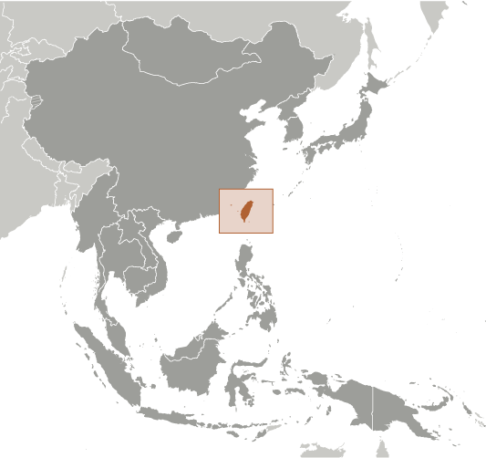
Eastern Asia, islands bordering the East China Sea, Philippine Sea, South China Sea, and Taiwan Strait, north of the Philippines, off the southeastern coast of China Geographic coordinates
23 30 N, 121 00 E
Map references
Southeast Asia
Area World Ranking: 139
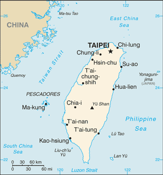
Total 35,980 sq km
Land 32,260 sq km Water 3,720 sq km Note Includes the Pescadores, Matsu, and Quemoy islands Area - comparative
Slightly smaller than Maryland and Delaware combined Land boundaries
0 km
Coastline
1,566.3 km
Maritime claims
Territorial sea 12 nm
Exclusive economic zone 200 nm Climate
Tropical; marine; rainy season during southwest monsoon (June to August); cloudiness is persistent and extensive all year Terrain
Eastern two-thirds mostly rugged mountains; flat to gently rolling plains in west Elevation extremes
Lowest point South China Sea 0 m
Highest point Yu Shan 3,952 m Natural resources
Small deposits of coal, natural gas, limestone, marble, and asbestos Land use
Arable land 24%
Permanent crops 1% Other 75% (2001) Irrigated land
NA
Total renewable water resources
67 cu km (2000)
Natural hazards
Earthquakes; typhoons
Volcanism Kueishantao Island (elev. 401 m), east of Taiwan, is its only historically active volcano, although it has not erupted in centuries Environment - current issues
Air pollution; water pollution from industrial emissions, raw sewage; contamination of drinking water supplies; trade in endangered species; low-level radioactive waste disposal Environment - international agreements
Party to
None of the selected agreements because of Taiwan's international status Geography - note
Strategic location adjacent to both the Taiwan Strait and the Luzon Strait
Comments
Add a new comment: |
Advertisement
Members area
Taiwan (Taipei):
GPS points from Taiwan (Taipei)
|
||||||||
 In 1895, military defeat forced China to cede Taiwan to Japan. Taiwan reverted to Chinese control after World War II. Following the Communist victory on the mainland in 1949, 2 million Nationalists fled to Taiwan and established a government using the 1947 constitution drawn up for all of China. Over the next five decades, the ruling authorities gradually democratized and incorporated the local population within the governing structure. In 2000, Taiwan underwent its first peaceful transfer of power from the Nationalist to the Democratic Progressive Party. Throughout this period, the island prospered and became one of East Asia's economic "Tigers." The dominant political issues continue to be the relationship between Taiwan and China - specifically the question of Taiwan's eventual status - as well as domestic political and economic reform.