|
|
|
Advertisements:
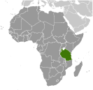
GeographyLocation
Eastern Africa, bordering the Indian Ocean, between Kenya and Mozambique Geographic coordinates
6 00 S, 35 00 E
Map references
Africa
Area World Ranking: 31
Total 947,300 sq km
Land 885,800 sq km Water 61,500 sq km Note Includes the islands of Mafia, Pemba, and Zanzibar Area - comparative
Slightly larger than twice the size of California Land boundaries
Total 3,861 km
Border countries Burundi 451 km, Democratic Republic of the Congo 459 km, Kenya 769 km, Malawi 475 km, Mozambique 756 km, Rwanda 217 km, Uganda 396 km, Zambia 338 km Coastline
1,424 km
Maritime claims
Territorial sea 12 nm
Exclusive economic zone 200 nm Climate
Varies from tropical along coast to temperate in highlands Terrain
Plains along coast; central plateau; highlands in north, south Elevation extremes
Lowest point Indian Ocean 0 m
Highest point Kilimanjaro 5,895 m Natural resources
Hydropower, tin, phosphates, iron ore, coal, diamonds, gemstones, gold, natural gas, nickel Land use
Arable land 4.23%
Permanent crops 1.16% Other 94.61% (2005) Irrigated land
1,840 sq km (2003)
Total renewable water resources
91 cu km (2001)
Freshwater withdrawal (domestic/industrial/agricultural)
Total 5.18 cu km/yr (10%/0%/89%)
Per capita 135 cu m/yr (2000) Natural hazards
Flooding on the central plateau during the rainy season; drought Volcanism Limited volcanic activity; Ol Doinyo Lengai (elev. 2,962 m) has emitted lava in recent years; other historically active volcanoes include Kieyo and Meru Environment - current issues
Soil degradation; deforestation; desertification; destruction of coral reefs threatens marine habitats; recent droughts affected marginal agriculture; wildlife threatened by illegal hunting and trade, especially for ivory Environment - international agreements
Party to
Biodiversity, Climate Change, Climate Change-Kyoto Protocol, Desertification, Endangered Species, Hazardous Wastes, Law of the Sea, Ozone Layer Protection, Wetlands Signed, but not ratified None of the selected agreements Geography - note
Kilimanjaro is the highest point in Africa and one of only two mountains on the continent that has glaciers (the other is Mount Kenya); bordered by three of the largest lakes on the continent: Lake Victoria (the world's second-largest freshwater lake) in the north, Lake Tanganyika (the world's second deepest) in the west, and Lake Nyasa (Lake Malawi) in the southwest
Comments
Add a new comment: |
Advertisement
Members area
Tanzania (Dodoma):
 
GPS points from Tanzania (Dodoma)
|
||||||||

 Shortly after achieving independence from Britain in the early 1960s, Tanganyika and Zanzibar merged to form the nation of Tanzania in 1964. One-party rule ended in 1995 with the first democratic elections held in the country since the 1970s. Zanzibar's semi-autonomous status and popular opposition have led to two contentious elections since 1995, which the ruling party won despite international observers' claims of voting irregularities. The formation of a government of national unity between Zanzibar's two leading parties succeeded in minimizing electoral tension in 2010.