|
|
Advertisements:
GovernmentCountry name
Conventional long form Republic of The Gambia
Conventional short form The Gambia Government type
Republic
Capital
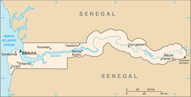
Name Banjul
Geographic coordinates 13 27 N, 16 34 W Time difference UTC 0 (5 hours ahead of Washington, DC during Standard Time) Administrative divisions
5 divisions and 1 city*; Banjul*, Central River, Lower River, North Bank, Upper River, Western Independence
18 February 1965 (from the UK)
Constitution
Approved by national referendum 8 August 1996; effective 16 January 1997 Legal system
Mixed legal system of English common law, Islamic law, and customary law International law organization participation
Accepts compulsory ICJ jurisdiction with reservations; accepts ICCt jurisdiction Suffrage
18 years of age; universal
Executive branch
Chief of state
President Yahya JAMMEH (since 18 October 1996); note - from 1994 to 1996 he was chairman of the junta; Vice President Isatou NJIE-SAIDY (since 20 March 1997); note - the president is both the chief of state and head of government Head of government President Yahya JAMMEH (since 18 October 1996); Vice President Isatou NJIE-SAIDY (since 20 March 1997) Cabinet Cabinet appointed by the president Elections President elected by popular vote for a five-year term (no term limits); election last held on 24 November 2011 (next to be held in 2016) Election results Yahya JAMMEH reelected president; percent of vote - Yahya JAMMEH 71.5%, Ousainou DARBOE 17.4%, Hamat BAH 11.1% Legislative branch
Unicameral National Assembly (53 seats; 48 members elected by popular vote, 5 appointed by the president; members to serve five-year terms) Elections Last held on 29 March 2012 (next to be held in 2017) Election results Percent of vote by party - APRC 51.8%, independents 38.8%, NRP 9.4%; seats by party - APRC 43, independents 4, NRP 1 Note Except for the NRP, all opposition parties boycotted the 29 March 2012 legislative elections Judicial branch
Supreme Court
Political parties and leaders
Alliance for Patriotic Reorientation and Construction or APRC [Yahya A. J. J. JAMMEH] (the ruling party); Gambia People's Democratic Party or GPDP [Henry GOMEZ]; National Alliance for Democracy and Development or NADD [Halifa SALLAH]; National Convention Party or NCP [Sheriff DIBBA]; National Reconciliation Party or NRP [Hamat N. K. BAH]; People's Democratic Organization for Independence and Socialism or PDOIS [Halifa SALLAH]; United Democratic Party or UDP [Ousainou DARBOE] Political pressure groups and leaders
National Environment Agency or NEA; West African Peace Building Network-Gambian Chapter or WANEB-GAMBIA; Youth Employment Network Gambia or YENGambia Other Special needs group advocates; teachers and principals International organization participation
ACP, AfDB, AU, C, ECOWAS, FAO, G-77, IBRD, ICAO, ICRM, IDA, IDB, IFAD, IFC, IFRCS, ILO, IMF, IMO, Interpol, IOC, IOM, IPU, ISO (correspondent), ITSO, ITU, ITUC, MIGA, NAM, OIC, OPCW, UN, UNAMID, UNCTAD, UNESCO, UNIDO, UNMIL, UNOCI, UNWTO, UPU, WCO, WFTU, WHO, WIPO, WMO, WTO Diplomatic representation in the us
Chief of mission Ambassador Alieu Momodou NGUM
Chancery Suite 240, Georgetown Plaza, 2233 Wisconsin Avenue NW, Washington, DC 20007 Telephone [1] (202) 785-1379, 1399, 1425FAX [1] (202) 785-1430 Diplomatic representation from the us
Chief of mission Ambassador Edward M. ALFORD
Embassy Kairaba Avenue, Fajara, Banjul Mailing address P. M. B. No. 19, Banjul Telephone [220] 439-2856, 437-6169, 437-6170 FAX [220] 439-2475Flag description
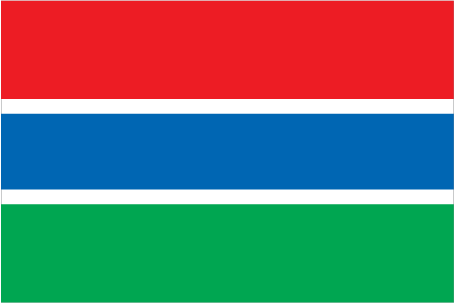
Three equal horizontal bands of red (top), blue with white edges, and green; red stands for the sun and the savannah, blue represents the Gambia River, and green symbolizes forests and agriculture; the white stripes denote unity and peace National symbol(s)
Lion
National anthem
Name "For The Gambia, Our Homeland"
Lyrics/music Virginia Julie HOWE/adapted by Jeremy Frederick HOWE Note Adopted 1965; the music is an adaptation of the traditional Mandinka song "Foday Kaba Dumbuya"
Comments
Add a new comment: |
Advertisement
Members area
The Gambia (Banjul):
 
GPS points from The Gambia (Banjul)
|
||||||||

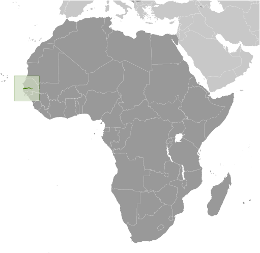
 The Gambia gained its independence from the UK in 1965. Geographically surrounded by Senegal, it formed a short-lived federation of Senegambia between 1982 and 1989. In 1991 the two nations signed a friendship and cooperation treaty, but tensions have flared up intermittently since then. Yahya JAMMEH led a military coup in 1994 that overthrew the president and banned political activity. A new constitution and presidential elections in 1996, followed by parliamentary balloting in 1997, completed a nominal return to civilian rule. JAMMEH has been elected president in all subsequent elections including most recently in late 2011.