|
|
Advertisements:
GeographyLocation
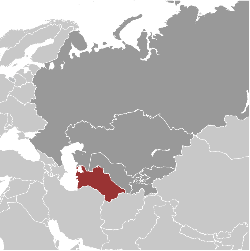
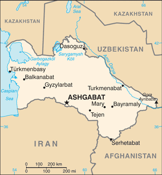
Central Asia, bordering the Caspian Sea, between Iran and Kazakhstan Geographic coordinates
40 00 N, 60 00 E
Map references
Asia
Area World Ranking: 53
Total 488,100 sq km
Land 469,930 sq km Water 18,170 sq km Area - comparative
Slightly larger than California Land boundaries
Total 3,736 km
Border countries Afghanistan 744 km, Iran 992 km, Kazakhstan 379 km, Uzbekistan 1,621 km Coastline
0 km; note - Turkmenistan borders the Caspian Sea (1,768 km) Maritime claims
None (landlocked)
Climate
Subtropical desert
Terrain
Flat-to-rolling sandy desert with dunes rising to mountains in the south; low mountains along border with Iran; borders Caspian Sea in west Elevation extremes
Lowest point Vpadina Akchanaya -81 m
Note Sarygamysh Koli is a lake in northern Turkmenistan with a water level that fluctuates above and below the elevation of Vpadina Akchanaya (the lake has dropped as low as -110 m) Highest point Gora Ayribaba 3,139 mNatural resources
Petroleum, natural gas, sulfur, salt Land use
Arable land 4.51%
Permanent crops 0.14% Other 95.35% (2005) Irrigated land
18,000 sq km (2003)
Total renewable water resources
60.9 cu km (1997)
Freshwater withdrawal (domestic/industrial/agricultural)
Total 24.65 cu km/yr (2%/1%/98%)
Per capita 5,104 cu m/yr (2000) Natural hazards
NA
Environment - current issues
Contamination of soil and groundwater with agricultural chemicals, pesticides; salination, water logging of soil due to poor irrigation methods; Caspian Sea pollution; diversion of a large share of the flow of the Amu Darya into irrigation contributes to that river's inability to replenish the Aral Sea; desertification Environment - international agreements
Party to
Biodiversity, Climate Change, Climate Change-Kyoto Protocol, Desertification, Hazardous Wastes, Ozone Layer Protection Signed, but not ratified None of the selected agreements Geography - note
Landlocked; the western and central low-lying desolate portions of the country make up the great Garagum (Kara-Kum) desert, which occupies over 80% of the country; eastern part is plateau
Comments
Add a new comment: |
Advertisement
Members area
Turkmenistan (Ashgabat):
 
GPS points from Turkmenistan (Ashgabat)
|
||||||||

 Present-day Turkmenistan covers territory that has been at the crossroads of civilizations for centuries. The area was ruled in antiquity by various Persian empires, and was conquered by Alexander the Great, Muslim crusaders, the Mongols, Turkic warriors, and eventually the Russians. In medieval times Merv (today known as Mary) was one of the great cities of the Islamic world and an important stop on the Silk Road. Annexed by Russia in the late 1800s, Turkmenistan later figured prominently in the anti-Bolshevik movement in Central Asia. In 1924, Turkmenistan became a Soviet republic; it achieved independence upon the dissolution of the USSR in 1991. Extensive hydrocarbon/natural gas reserves, which have yet to be fully exploited, have begun to transform the country. Turkmenistan is moving to expand its extraction and delivery projects. The Turkmen Government is actively working to diversify its gas export routes beyond the still important Russian pipeline network. In 2010, new gas export pipelines that carry Turkmen gas to China and to northern Iran began operating, effectively ending the Russian monopoly on Turkmen gas exports. President for Life Saparmurat NYYAZOW died in December 2006, and Turkmenistan held its first multi-candidate presidential election in February 2007. Gurbanguly BERDIMUHAMEDOW, a deputy cabinet chairman under NYYAZOW, emerged as the country's new president; he was reelected in February 2012.