|
|
Advertisements:
GeographyLocation
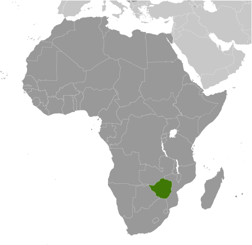
Southern Africa, between South Africa and Zambia Geographic coordinates
20 00 S, 30 00 E
Map references
Africa
Area World Ranking: 61
Total 390,757 sq km
Land 386,847 sq km Water 3,910 sq km Area - comparative
Slightly larger than Montana
Land boundaries
Total 3,066 km
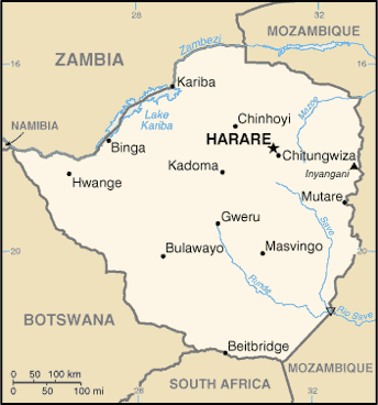
Border countries Botswana 813 km, Mozambique 1,231 km, South Africa 225 km, Zambia 797 km Coastline
0 km (landlocked)
Maritime claims
None (landlocked)
Climate
Tropical; moderated by altitude; rainy season (November to March) Terrain
Mostly high plateau with higher central plateau (high veld); mountains in east Elevation extremes
Lowest point
Junction of the Runde and Save Rivers 162 m Highest point Inyangani 2,592 mNatural resources
Coal, chromium ore, asbestos, gold, nickel, copper, iron ore, vanadium, lithium, tin, platinum group metals Land use
Arable land 8.24%
Permanent crops 0.33% Other 91.43% (2005) Irrigated land
1,740 sq km (2003)
Total renewable water resources
20 cu km (1987)
Freshwater withdrawal (domestic/industrial/agricultural)
Total 4.21 cu km/yr (14%/7%/79%)
Per capita 324 cu m/yr (2002) Natural hazards
Recurring droughts; floods and severe storms are rare Environment - current issues
Deforestation; soil erosion; land degradation; air and water pollution; the black rhinoceros herd - once the largest concentration of the species in the world - has been significantly reduced by poaching; poor mining practices have led to toxic waste and heavy metal pollution Environment - international agreements
Party to
Biodiversity, Climate Change, Desertification, Endangered Species, Law of the Sea, Ozone Layer Protection Signed, but not ratified None of the selected agreements Geography - note
Landlocked; the Zambezi forms a natural riverine boundary with Zambia; in full flood (February-April) the massive Victoria Falls on the river forms the world's largest curtain of falling water; Lake Kariba on the Zambia-Zimbabwe border forms the world's largest reservoir by volume (180 cu km; 43 cu mi)
Comments
Add a new comment: |
Advertisement
Members area
Zimbabwe (Harare):
 
GPS points from Zimbabwe (Harare)
|
||||||||

 The UK annexed Southern Rhodesia from the [British] South Africa Company in 1923. A 1961 constitution was formulated that favored whites in power. In 1965 the government unilaterally declared its independence, but the UK did not recognize the act and demanded more complete voting rights for the black African majority in the country (then called Rhodesia). UN sanctions and a guerrilla uprising finally led to free elections in 1979 and independence (as Zimbabwe) in 1980. Robert MUGABE, the nation's first prime minister, has been the country's only ruler (as president since 1987) and has dominated the country's political system since independence. His chaotic land redistribution campaign, which began in 2000, caused an exodus of white farmers, crippled the economy, and ushered in widespread shortages of basic commodities. Ignoring international condemnation, MUGABE rigged the 2002 presidential election to ensure his reelection. In April 2005, Harare embarked on Operation Restore Order, ostensibly an urban rationalization program, which resulted in the destruction of the homes or businesses of 700,000 mostly poor supporters of the opposition. President MUGABE in June 2007 instituted price controls on all basic commodities causing panic buying and leaving store shelves empty for months.