|
|
Weather Dekhi-Davud (Cloud cover, Temperature, Wind speed and Precipitation mm probab.)
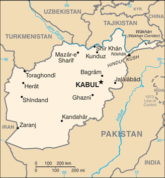
Map and Photos Dekhi-Davud
Comments
Add a new comment: |
Members area
Afghanistan (Kabul):
Advertisement
GPS points near Dekhi-Davud
 Dahan-e Manju (0.5km)
  Dakhani-Mandzhu (0.5km)
  Jar-e Deh Kalan (0.5km)
  Dekh-Kalan (0.5km)
  Jar-e Ghighonak (0.5km)
  Gigunak (0.5km)
  Dahan-e Ghighonak (1 km)
  Dakhani-Gigunak (1 km)
  Kajnaw (1 km)
  Kadzhnau (1 km)
  Giro-ye Sar-e Pol (2 km)
  Giro-i- Sare Pul (2 km)
  Naw-e Bala-ye Koshk (2 km)
  Naw Bala-i- Kusk (2 km)
  Nau- Balayi-Kushk (2 km)
  Zanburkhan (2 km)
  Zanbur Khan (2 km)
GPS points from Afghanistan (Kabul)
|


