42°34'0" N
1°37'0" E
~1,920m asl
00:28 (CEST - UTC/GMT+2)
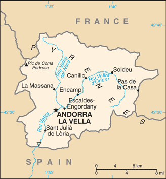
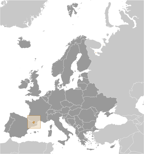
Canal de les Bordes (Canal de les Bordes) is a ravine(s) (class H - Hydrographic) in Parroquia de Canillo (Andorra (general)), Andorra (Europe) with the region font code of Americas/Western Europe. It is located at an elevation of 1,920 meters above sea level and its population amounts to 3,292.
Canal de les Bordes is also known as Visanceny, Visanseny.
Its coordinates are 42°34'0" N and 1°37'0" E in DMS (Degrees Minutes Seconds) or 42.5667 and 1.61667 (in decimal degrees). Its UTM position is CH81 and its Joint Operation Graphics reference is NK31-04.
Current local time is 00:28; the sun rises at 07:54 and sets at 20:01 local time (Europe/Andorra UTC/GMT+2). The standard time zone for Canal de les Bordes is UTC/GMT+1, but since Daylight Saving Time (DST) is in effect the current time zone is UTC/GMT+2.
In 2024 DST starts on 31 Mar 2024 and ends on 27 Oct 2024.
A Ravine(s) is a small, narrow, deep, steep-sided stream channel, smaller than a gorge.
|
Advertisements:
Advertisements:
|
Weather Canal de les Bordes (Cloud cover, Temperature, Wind speed and Precipitation mm probab.)
Thu
Apr 25
~6 l/m2 78%
3-6 cm (Snow)
-5 °C min
-2 °C max
10 km/h
Thu Jan 1
|
Fri
Apr 26
~9 l/m2 78%
5-9 cm (Snow)
-7 °C min
-1 °C max
13 km/h
Thu Jan 1
|
Sat
Apr 27
~38 l/m2 91%
22-38 cm (Snow)
-6 °C min
-1 °C max
15 km/h
Thu Jan 1
|
Sun
Apr 28
~19 l/m2 93%
11-19 cm (Snow)
-6 °C min
-0 °C max
12 km/h
Thu Jan 1
|
Mon
Apr 29
~39 l/m2 97%
23-39 cm (Snow)
-6 °C min
-4 °C max
8 km/h
Thu Jan 1
|
Tue
Apr 30
~43 l/m2 97%
25-43 cm (Snow)
-6 °C min
-2 °C max
8 km/h
Thu Jan 1
|
|
|
Visanseny (Parroquia de Canillo) 7 day forecast
Map and Photos Canal de les Bordes
--- There are no comments yet ---
Add a new comment:
|
Members area
Andorra (Andorra La Vella):
Advertisement
GPS points near Canal de les Bordes
GPS points from Andorra (Andorra La Vella)
|
 Els Puiols (1 km)