39°29'13" N
46°2'25" E
~1,724m asl
00:21 (AMT - UTC/GMT+4)
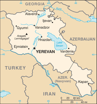
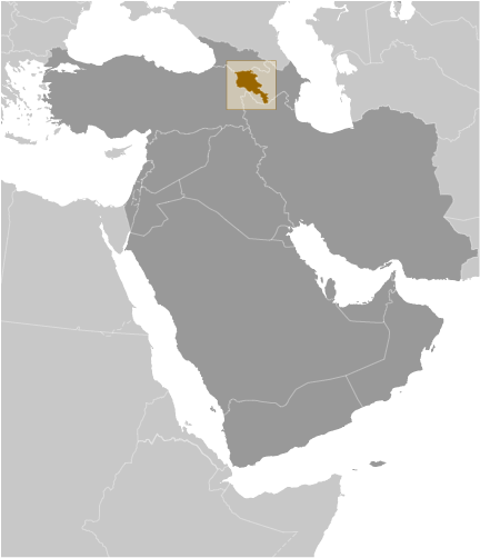
Ayry-chay (Ayry-chay) is a stream (class H - Hydrographic) in Armenia (general), Armenia (Asia) with the region font code of Eastern Europe. It is located at an elevation of 1,724 meters above sea level.
Ayry-chay is also known as Ayri, Ayrich'ay, Ayrich’ay, Ayriget, Ayrisu, Ayry-chay, Eyrich'ai, Eyrich’ai.
Its coordinates are 39°29'13" N and 46°2'25" E in DMS (Degrees Minutes Seconds) or 39.4869 and 46.0403 (in decimal degrees). Its UTM position is NJ87 and its Joint Operation Graphics reference is NJ38-03.
Current local time is 00:21; the sun rises at 08:54 and sets at 21:01 local time (Asia/Yerevan UTC/GMT+4). The standard time zone for Ayry-chay is UTC/GMT+4
In 2024 DST starts on - and ends on -.
A Stream is a body of running water moving to a lower level in a channel on land.
|
Advertisements:
Advertisements:
|
Weather Ayry-chay (Cloud cover, Temperature, Wind speed and Precipitation mm probab.)
Thu
Apr 25
10 °C min
11 °C max
11 km/h
Thu Jan 1
|
Fri
Apr 26
5 °C min
16 °C max
13 km/h
Thu Jan 1
|
Sat
Apr 27
4 °C min
16 °C max
14 km/h
Thu Jan 1
|
Sun
Apr 28
3 °C min
18 °C max
10 km/h
Thu Jan 1
|
Mon
Apr 29
6 °C min
18 °C max
12 km/h
Thu Jan 1
|
Tue
Apr 30
6 °C min
18 °C max
11 km/h
Thu Jan 1
|
|
|
Ayriget (Armenia (general)) 7 day forecast
--- There are no comments yet ---
Add a new comment:
|
Members area
Armenia (Yerevan):
Advertisement
GPS points near Ayry-chay
GPS points from Armenia (Yerevan)
 Dian Aragatsotni Marz
|