English   Română   Español   Français   Deutsch  

getamap.net

Africa

Oceania

Asia

North America

Europe

South America

Antarctica


Amasia

/ Shiraki Marz

40°56'48" N
43°46'53" E
~1,818m asl
06:10 (AMT - UTC/GMT+4)

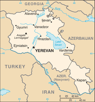
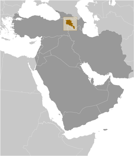
Amasia (Amasia) is a populated place (class P - Populated Place) in Shiraki Marz (Shirak), Armenia (Asia) with the region font code of Eastern Europe. It is located at an elevation of 1,818 meters above sea level and its population amounts to 1,675.
Amasia is also known as Amasia, Amasija, Amasiya, Gukasyan, Амасия.

Its coordinates are 40°56'48" N and 43°46'53" E in DMS (Degrees Minutes Seconds) or 40.9467 and 43.7814 (in decimal degrees). Its UTM position is LL93 and its Joint Operation Graphics reference is NK38-10.

Current local time is 06:10; the sun rises at 08:54 and sets at 21:01 local time (Asia/Yerevan UTC/GMT+4). The standard time zone for Amasia is UTC/GMT+4
In 2024 DST starts on - and ends on -.

A Populated place is a city, town, village, or other agglomeration of buildings where people live and work.


Country
 Advertisements:


 Advertisements:


Weather Amasia (Cloud cover, Temperature, Wind speed and Precipitation mm probab.)

Wed


Apr 24
Clound 0-10-20-100
 
11 °C min
12 °C max
6 km/h
Thu Jan 1

Thu


Apr 25
Clound 0-0-0-40
 
6 °C min
18 °C max
13 km/h
Thu Jan 1

Fri


Apr 26
Clound 0-0-0-70
 
7 °C min
19 °C max
13 km/h
Thu Jan 1

Sat


Apr 27
Clound 0-10-10-30
~3 l/m2 26%
 
6 °C min
17 °C max
15 km/h
Thu Jan 1

Sun


Apr 28
Clound 0-10-0-20
~1 l/m2 23%
 
5 °C min
18 °C max
15 km/h
Thu Jan 1

Mon


Apr 29
Clound 0-10-20-30
~1 l/m2 25%
 
8 °C min
19 °C max
11 km/h
Thu Jan 1

Weather Graph

Amasia (Shiraki Marz) 7 day forecast
 

Map and Photos Amasia


Comments

--- There are no comments yet ---


Add a new comment:


You have to log in to add a comment!


Members area


Register

Forgot password?

Armenia (Yerevan):

Advertisement


GPS points near Amasia

square Bandivan (2 km)


square Dashkerpi (2 km)

square Aregnadem (3 km)

square Azizbekov (3 km)

square Karachanta (3 km)

square Chalab (3 km)

square Dzhalab (3 km)

square Dzhradzor (3 km)

square Jradzor (3 km)

square Alakilisa (3 km)

square Baytar (3 km)

square Hovtun (3 km)

square Illi (4 km)


square Taknali (4 km)

square Gtashen (6 km)


GPS points from Armenia (Yerevan)

square Dzoragyukh Geghark'unik'i Marz

square Arpavar Ararati Marz

square Tsakhkaovit Aragatsotni Marz

square Lerrnajur Armenia (general)

square Ayaslu Ararati Marz

square Elagyoz Lerrnagagat' Armenia (general)

square Kyumyurlyu Armenia (general)

square Gora Saryyatakh Syunik'i Marz


viewweather.com sv.ViewWeather.com
fr.ViewWeather.com
da.ViewWeather.com
de.ViewWeather.com
es.ViewWeather.com
www.carpati.org
www.searchromania.net
Deblocari usi
es.getamap.org
fr.getamap.org
de.getamap.org
nl.getamap.org
da.getamap.org
www.getamap.org
Links
Terms of use
Privacy policy

# 0.0630 sec 

contact AT getamap.net

© 2006 - 2024  https://www.getamap.net/