|

Administrative divisions (GPS Maps)
Geography
People and Society
Government
Economy
Communications
Transportation
Military |
 |
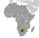 Formerly the British protectorate of Bechuanaland, Botswana adopted its new name upon independence in 1966. Four decades of uninterrupted civilian leadership, progressive social policies, and significant capital investment have created one of the most dynamic economies in Africa. Mineral extraction, principally diamond mining, dominates economic activity, though tourism is a growing sector due to the country's conservation practices and extensive nature preserves. Botswana has one of the world's highest known rates of HIV/AIDS infection, but also one of Africa's most progressive and comprehensive programs for dealing with the disease. Formerly the British protectorate of Bechuanaland, Botswana adopted its new name upon independence in 1966. Four decades of uninterrupted civilian leadership, progressive social policies, and significant capital investment have created one of the most dynamic economies in Africa. Mineral extraction, principally diamond mining, dominates economic activity, though tourism is a growing sector due to the country's conservation practices and extensive nature preserves. Botswana has one of the world's highest known rates of HIV/AIDS infection, but also one of Africa's most progressive and comprehensive programs for dealing with the disease. |
|
Advertisements
|
Advertisements
|
Administrative divisions (1,428 GPS Maps)
--- There are no comments yet ---
Add a new comment:
|
Advertisement
Members area
Botswana (Gaborone):
GPS points from Botswana (Gaborone)
 Boro Botswana (general)
|
