|

Administrative divisions (GPS Maps)
Geography
People and Society
Government
Economy
Communications
Transportation
Military |
 |
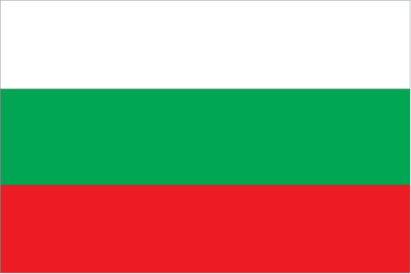
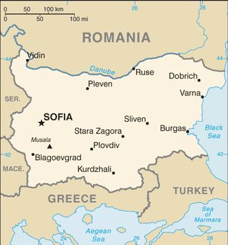
 The Bulgars, a Central Asian Turkic tribe, merged with the local Slavic inhabitants in the late 7th century to form the first Bulgarian state. In succeeding centuries, Bulgaria struggled with the Byzantine Empire to assert its place in the Balkans, but by the end of the 14th century the country was overrun by the Ottoman Turks. Northern Bulgaria attained autonomy in 1878 and all of Bulgaria became independent from the Ottoman Empire in 1908. Having fought on the losing side in both World Wars, Bulgaria fell within the Soviet sphere of influence and became a People's Republic in 1946. Communist domination ended in 1990, when Bulgaria held its first multiparty election since World War II and began the contentious process of moving toward political democracy and a market economy while combating inflation, unemployment, corruption, and crime. The country joined NATO in 2004 and the EU in 2007. The Bulgars, a Central Asian Turkic tribe, merged with the local Slavic inhabitants in the late 7th century to form the first Bulgarian state. In succeeding centuries, Bulgaria struggled with the Byzantine Empire to assert its place in the Balkans, but by the end of the 14th century the country was overrun by the Ottoman Turks. Northern Bulgaria attained autonomy in 1878 and all of Bulgaria became independent from the Ottoman Empire in 1908. Having fought on the losing side in both World Wars, Bulgaria fell within the Soviet sphere of influence and became a People's Republic in 1946. Communist domination ended in 1990, when Bulgaria held its first multiparty election since World War II and began the contentious process of moving toward political democracy and a market economy while combating inflation, unemployment, corruption, and crime. The country joined NATO in 2004 and the EU in 2007. |
|
Advertisements
|
Advertisements
|
Administrative divisions (25,762 GPS Maps)
Blagoevgrad
(1,041)
|
Bulgaria (general)
(201)
|
Burgas
(1,910)
|
Dobrich
(1,347)
|
Gabrovo
(1,222)
|
Khaskovo
(1,324)
|
Kurdzhali
(1,747)
|
Kyustendil
(751)
|
Lovech
(744)
|
Montana
(574)
|
Pazardzhit
(740)
|
Pernik
(581)
|
Pleven
(573)
|
Plovdiv
(1,221)
|
Razgrad
(618)
|
Ruse
(416)
|
Shumen
(807)
|
Silistra
(656)
|
Sliven
(596)
|
Smolyan
(1,009)
|
Sofiya
(1,342)
|
Sofiya-Grad
(400)
|
Stara Zagora
(1,111)
|
Turgovishte
(870)
|
Varna
(971)
|
Veliko Turnovo
(1,351)
|
Vidin
(527)
|
Vratsa
(484)
|
Yambol
(628)
|
--- There are no comments yet ---
Add a new comment:
|
Advertisement
Members area
Bulgaria (Sofia):
GPS points from Bulgaria (Sofia)
|


